


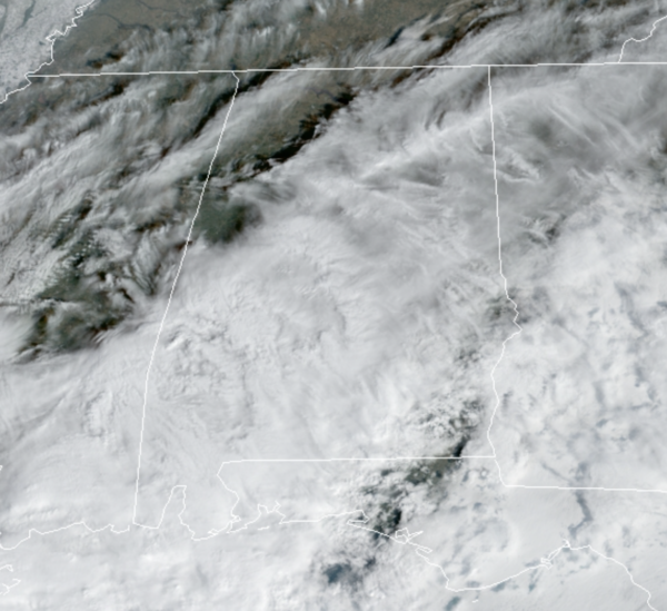
Clouds have returned to the Alabama sky today, but despite the clouds, we stay dry. There are a few showers across far South Alabama, but even there rainfall is very light. Temperatures this afternoon are generally in the low 50s. The clouds clear out tonight and lows tomorrow morning will be in the upper 20s to lower 30s.
REST OF WEEK: Great weather highlights our forecast the rest of this week with sunny days and a warming trend. Highs tomorrow will return to the upper 50s, followed by low and mid 60s Wednesday through Friday. Nights will be clear and chilly with lows in low 30s.
THE ALABAMA WEEKEND: Saturday will be a dry day with a partly sunny sky and highs again in the 60s. A cold front will pass through Saturday night, but moisture will be very limited so widespread precipitation is not expect. However, a few areas of light rain or flurries can’t be ruled out, but for now it looks like most places will be dry. Sunday will be sunny, dry, and much colder with a highs in the upper 40s, also add in a brisk north wind making it feel colder.
NEXT WEEK: The weather looks dry Monday and Tuesday with highs in the 50s, with temperatures likely rising into the 60s Wednesday. Long range looks to feature warmer temperatures the deep we get into February. As far as rain, we could see a disturbance bring some risk of rain by Wednesday night and Thursday.
BEACH FORECAST CENTER: Get the latest weather and rip current forecasts for the beaches from Fort Morgan to Panama City on our Beach Forecast Center page. There, you can select the forecast of the region that you are interested in visiting.
WORLD TEMPERATURE EXTREMES: Over the last 24 hours, the highest observation outside the U.S. was 108.9F at Eucla Amo Australia. The lowest observation was -55.8F at Delyankir, Russia.
CONTIGUOUS TEMPERATURE EXTREMES: Over the last 24 hours, the highest observation was 85F at Anaheim, CA. The lowest observation was -23F at Seagull Lake, MN .



