


A front is ever so slowly pushing through the state today and will continue to be the forcing mechanism for widespread showers and storms for the rest of today. Periods of rain from this morning continue into this afternoon in a few spots and at midday, we are watching a cluster of showers and storms lifting northeast through Central Alabama.
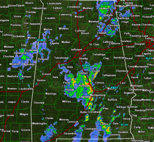
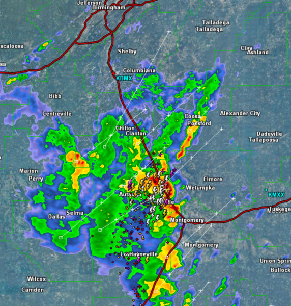
These have been impacting locations in and around Selma, Hayneville, Prattville and Montgomery and will continue to track northeast impacting areaa near Clanton, Wetumpka, Rockford, Talladega, and Ashland. These storms are producing tremendous amounts of lightning and very heavy rainfall which could lead to isolated flash flooding.
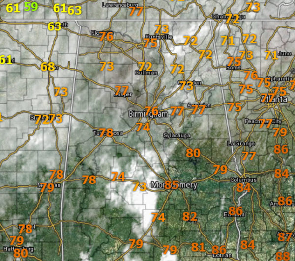
Where it is not raining, it remains mainly cloudy and very muggy with temperatures ranging from the low to mid 70s to lower 80s.
With such a moisture-rich air mass in place, rain is and will be possible at anytime at any location. We should continue to see the radar become more active through the afternoon hours as daytime heating allows for numerous showers and storms. After the sun sets, we should begin to see most of the activity begin to wind down.
FRIDAY AND THE WEEKEND: The front will push into South Alabama tomorrow and the ridge begins to strengthen and for most of North/Central Alabama, these days will be dry with mostly sunny and warm conditions with fair, pleasant nights. The showers and storms should be confined to the southern counties of the state, along and south of the front. Look for highs in the low 80s tomorrow, and mid 80s over the weekend. Morning lows will be well down in the 60s.
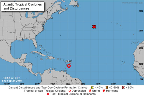
IN THE TROPICS: Kirk will move through the Lesser Antilles today, but it is expected to dissipate over the Caribbean over the weekend due to shear. A large circulation over the North Atlantic could become Subtropical Storm Leslie again today, but it is far from land. The rest of the Atlantic basin is quiet and the Gulf of Mexico remains quiet with no storm activity through the weekend.
BEACH FORECAST CENTER: Get the latest weather and rip current forecasts for the beaches from Fort Morgan to Panama City on our Beach Forecast Center page. There, you can select the forecast of the region that you are interested in visiting.
WORLD TEMPERATURE EXTREMES: Over the last 24 hours, the highest observation outside the U.S. was 113.2F at Mitribah, Kuwait. The lowest observation was -97.6F at Dome A, Antarctica.
CONTIGUOUS TEMPERATURE EXTREMES: The highest observation was 109F at Death Valley, CA. The lowest observation was 24F at Gunnison, CO.
WEATHER ON THIS DATE IN 1959: A tornado 440 yards in width traveled twenty miles from near Hollow, OK, to western Cherokee County KS. Although a strong tornado, it was very slow moving, and gave a tremendous warning roar, and as a result no one was killed.



