


A very muggy air mass remains in place across the state and that continues to allow for more clouds than sun with temperatures in the upper 70s and lower 80s for most locations.
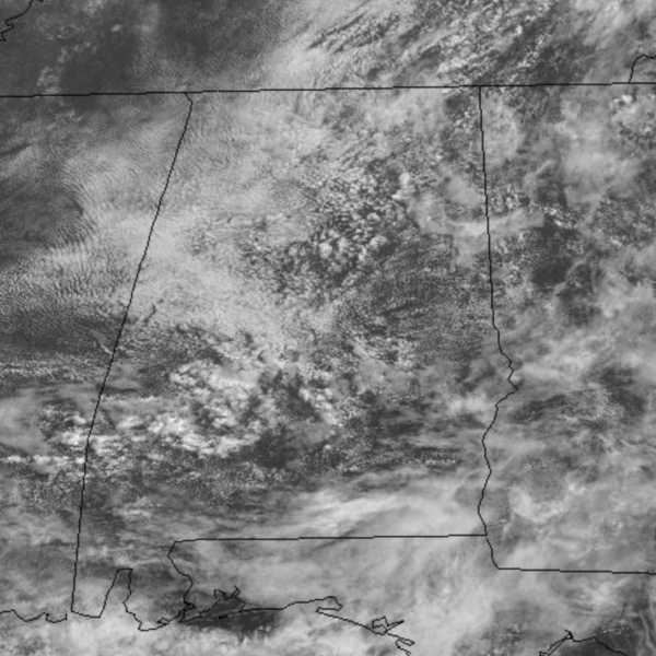
A few showers are possible any time, but as we head into the afternoon hours, showers and storms will become more numerous in coverage.
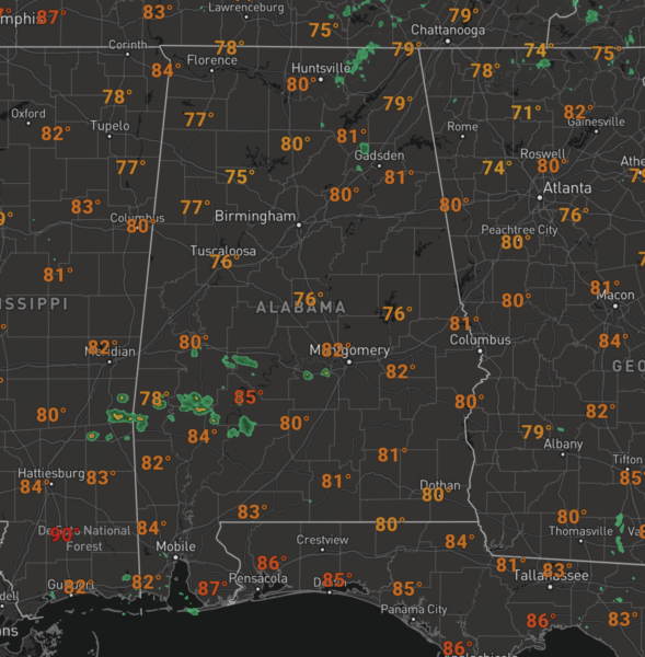
Not much change in the forecast for tomorrow, but we should see a bit of a decrease in the showers and storms, but still they will remain in the forecast.
ELSA MOVING THROUGH CAROLINAS: The center of Tropical Storm Elsa was located near latitude 35.0 North, longitude 79.7 West. Elsa is moving toward the northeast near 20 mph, and this general motion is expected to continue with an increase in forward speed during the next couple of days. On the forecast track, Elsa will move over South Carolina and North Carolina today, pass near the eastern mid-Atlantic states by tonight, and move near or over the northeastern United States on Friday and Friday night. The system should move over Atlantic Canada by Friday night and Saturday.
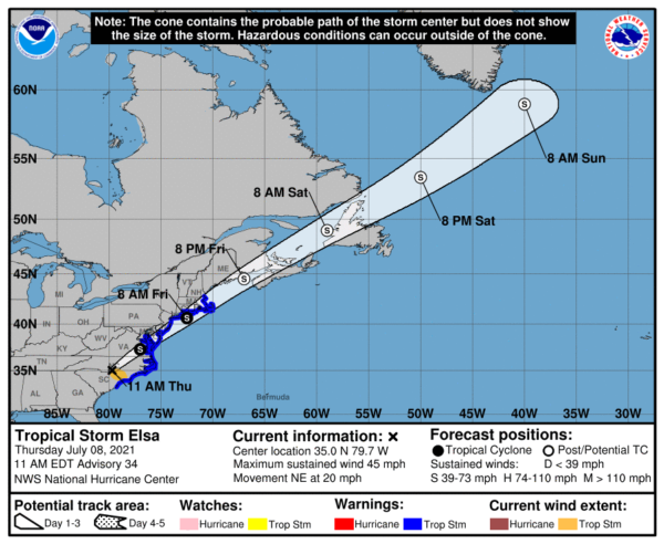
Maximum sustained winds are near 45 mph with higher gusts. Some strengthening is possible tonight and Friday while the system moves close to the northeastern United States. Elsa is forecast to become a post-tropical cyclone by Friday night. Tropical-storm-force winds extend outward up to 115 miles from the center. A buoy near Sunset Beach, North Carolina, recently reported a sustained wind of 40 mph gusting to 58 mph. The estimated minimum central pressure is 1006 mb (29.71 inches).
Rest of the Atlantic Basin is quiet with not tropical cyclone development through the weekend.
THE ALABAMA WEEKEND: Pretty standard summer weather for the week as both days, we will mention the chance for widely scattered, mostly afternoon and evening showers and thunderstorms both Saturday and Sunday. Rain chances should be in the 20-30% range, and you can expect a partly cloudy to mostly cloudy sky with highs in the upper 80s.
NEXT WEEK: Monday should feature better rain chances as an upper trough passes nearby. For the res of the wee, we are forecasting fairly typical mid-summer weather in Alabama; partly sunny days, and as usual the chance of a few pop-up scattered storms each afternoon and evenings. Highs much of next week, should be on either side of the 90 degree mark.
BEACH FORECAST CENTER: Get the latest weather and rip current forecasts for the beaches from Fort Morgan to Panama City on our Beach Forecast Center page. There, you can select the forecast of the region that you are interested in visiting.
WORLD TEMPERATURE EXTREMES: Over the last 24 hours, the highest observation outside the U.S. was 123.1F at Jahra, Kuwait. The lowest observation was -92.6F at Vostok, Antarctica.
CONTIGUOUS TEMPERATURE EXTREMES: Over the last 24 hours, the highest observation was 126F at Death Valley, CA. The lowest observation was 42F at Peter Sinks, UT.
WEATHER ON THIS DATE IN 1950: The town of York, NE, was deluged with 13.15 inches of rain in 24 hours to establish a state record.



