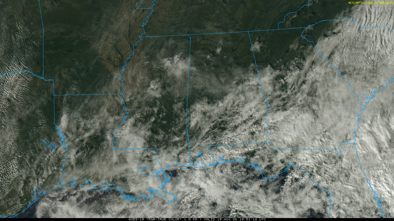
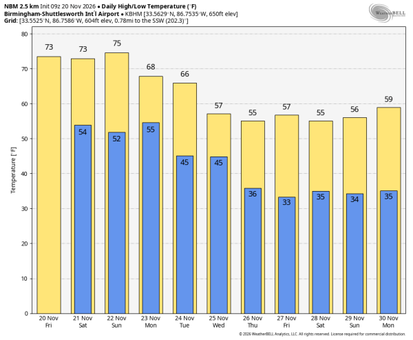
MILD AFTERNOONS: Most of Alabama will enjoy a high in the low to mid 70s each day through Sunday, well above average for late November. A few sprinkles are possible across the southeast part of the state today and tomorrow, but most places will be dry through Sunday with a mix of sun and clouds.
THANKSGIVING WEEK: A front could squeeze out a few showers late Sunday night and Monday, but most places won’t see a drop with a relatively dry airmass in place. Then, an upper trough will bring a chance of some rain on Wednesday, but amounts will be light. For now the weather looks cool and dry Thanksgiving Day and Black Friday with highs in the 50s and lows in the 30s.
Global models continue to suggest rain at times on Iron Bowl Saturday with the next trough coming through in the southern branch of the jet stream… See the video briefing for maps, graphics, and more details.
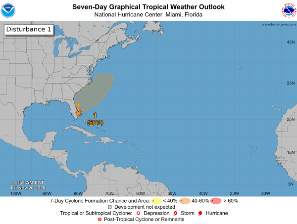
TROPICS: Surface observations indicate that a broad low pressure area has formed over southeastern Florida, the northwestern Bahamas, and the adjacent waters. The low is currently producing disorganized showers and thunderstorms extending from the central Florida peninsula east-southeastward over the Atlantic. This system could acquire subtropical or tropical characteristics while it moves generally northward to north-northeastward near or just offshore of the southeastern United States coast through the weekend.
Regardless of subtropical or tropical development, the system is expected to produce strong, gusty winds, dangerous surf, rip currents and coastal flooding along portions of the southeast and mid-Atlantic U.S. coasts into early next week. In addition, heavy rainfall and the threat of flash flooding will continue across portions of the Florida peninsula today, potentially spreading northward toward coastal portions of the Carolinas and the mid-Atlantic over the weekend.
The chance of development is 50 percent; no tropical issues for the Gulf for the rest of November.
FOOTBALL WEATHER: Alabama hosts Chattanooga Saturday at Bryant-Denny Stadium (1:00p CT kickoff)… expect a partly sunny sky with temperatures in the low to mid 70s.
Auburn also is at home; they play Samford at Jordan-Hare Stadium (2:30p CT kickoff). The sky will be mostly cloudy; we will mention a small risk of a few sprinkles during the game. Temperatures will be in the low 70s at kickoff, falling into the upper 60s during the second half.
For other games, most of the Deep South will be rain-free Saturday/Saturday night… most of the rain will be southeast of Alabama.
ON THIS DATE IN 1985: Kate intensified to a major Category 3 hurricane and as she moved west of Key West, Florida with top winds of 115 mph and a minimum central pressure of 954 millibars or 28.17 inches of mercury. The next day Kate made landfall between Panama City and Apalachicola.
ON THIS DATE IN 1988: A tornado struck the southern part of Tuscaloosa early on Sunday morning, November 20, 1988, at 12:53 a.m., heavily damaging 15 homes and injuring seven people. The storm, produced by a strong cold front, caused 25 homes to sustain light to moderate damage and 50 others to suffer minor damage. Three individuals required hospitalization for injuries, including broken limbs, but no fatalities were reported.
Look for the next video update here by 3:00 this afternoon… enjoy the day!