


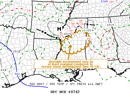
The Storm Prediction Center says that the storms currently pushing southeast across West Central Mississippi may intensify enough over the next couple of hours to warrant a severe thunderstorm watch for Central Mississippi into West Central Alabama.
The airmass in front of the storms is moderately unstable. CAPE values are over 1,000 j/kg over Mississippi and between 500-1,000 j/kg over Alabama. But those instabilities still have plenty of time to rise before the storms reach Alabama.
The greatest threat is large hail, mainly north and west of Jackson MS, but as the storms progress southeastward, they will continue to produce hail and could produce damaging winds. A severe thunderstorm warning is already in effect for three counties in the Mississippi Delta.
Ahead of the main activity, storms were increasing over Northwest Alabama. The heaviest activity is currently in Franklin and Lawrence counties, back to the Shoals. But storms were developing over Fayette into southwestern Walker County west of Jasper. Other cells were going up over Cullman County. The activity over Northwest Alabama will intensify as it moves over toward Madison and Morgan Counties.
The storms further south into Fayette and Walker Counties will also intensify as the airmass in front of them destabilizes further.



