


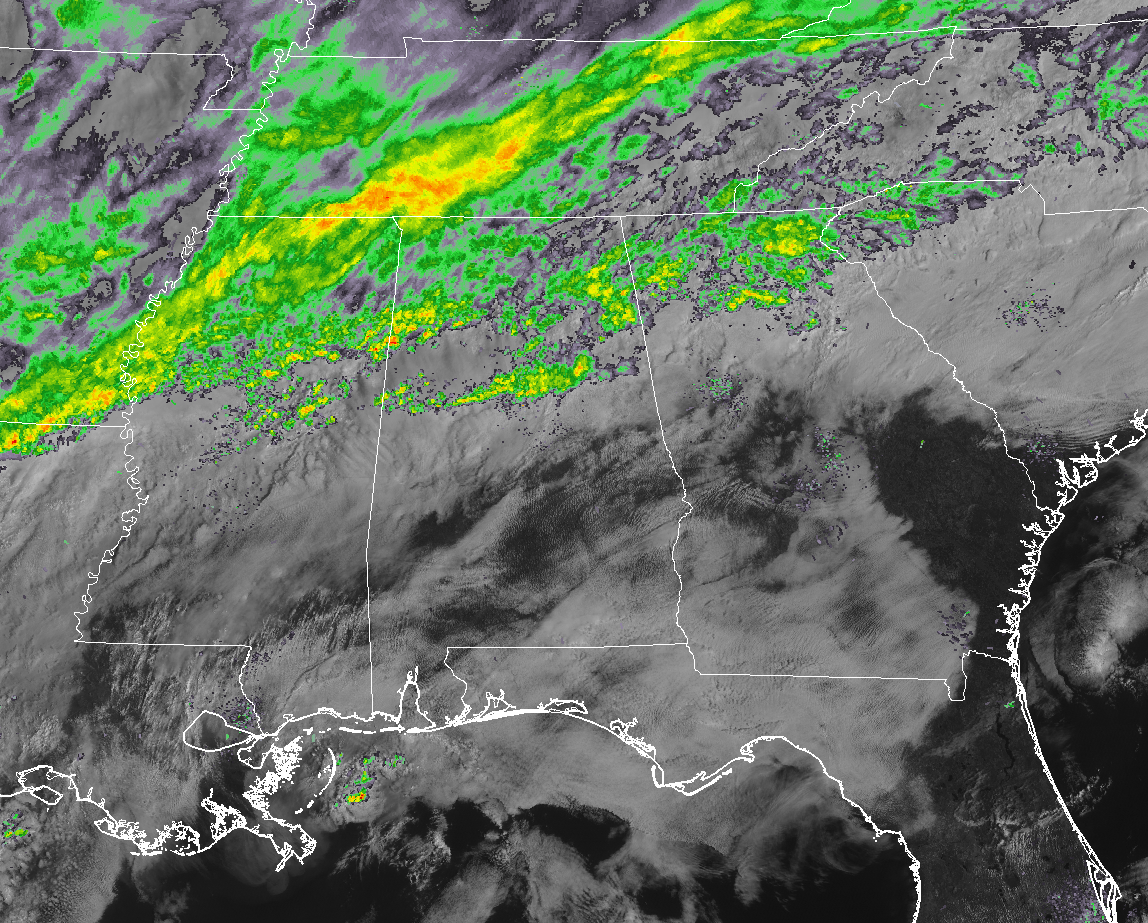
Southeast radar composite as of 9:25 am Friday.
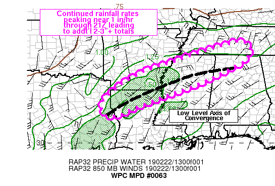
The latest from the Weather Prediction Office of the NWS states that rainfall amounts over the next six hours could reach as high as 1-3 inches over the north and northwestern parts of Alabama, leading to even more flooding issues. Here is the latest from the WPC:
Mesoscale Precipitation Discussion 0063
NWS Weather Prediction Center College Park MD
1004 AM EST Fri Feb 22 2019
Areas affected…northeast TX, southern AR, northern LA into northern MS
Concerning…Heavy rainfall…Flash flooding likely
Valid 221503Z – 222100Z
Summary…Only small adjustments are expected to an ongoing axis of moderate to heavy rain extending across portions of the Lower Mississippi Valley through 21Z. 6 hour rainfall totals of 1-3 inches, locally higher, can be expected.
Discussion…1430Z regional radar imagery showed a broad shield of warm advection driven rainfall extending from the central TX/LA border into northern MS and south-central TN. An axis of convergence centered near 850 mb was noted on area VAD wind plots and RAP analyses, co-located with a relatively narrow line of higher reflectivity values on radar imagery, with observed rainfall rates peaking near 1 in/hr within the line. GOES East water vapor imagery showed an inflection point lifting northeastward across the Ozarks with an inferred area of elongated vorticity extending southwestward into west-central TX tied to a weak mid-upper level trough axis.
RAP forecasts indicate that as the elongated vorticity max/subtle upper trough lifts out atop a strong subtropical ridge centered over the Caribbean, near neutral height falls will occur over the Lower Mississippi Valley and only a gradual northward shift to the axis of low level convergence through 21Z. Little change to the 850-300 mb mean wind and 850-700 mb wind fields are forecast through 21Z except for a small northward translation of low level convergence which may shift the focus for the heaviest rain rates over southern AR into far northern MS by 21Z. Given saturated soils and ongoing flooding occurring in many locations from the Mississippi River northeastward, continued flooding/flash flooding is expected. Farther to the southwest across the LA/AR border and far eastern TX, antecedent conditions are not as wet but training of heavy rain may lead to possible flash flood concerns where 2-3 inches of rain may fall over a 2-4 hour period.



