


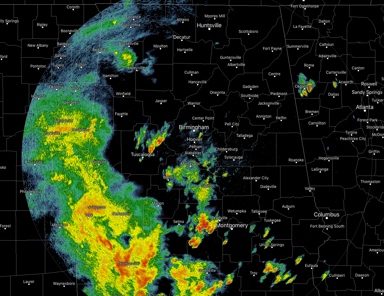
At 3:00 pm, we are continuing to have cells developing out ahead of the main mass of storms that are now moving into the southwestern parts of the area. We have a strong cluster moving through the northeastern parts of Tuscaloosa County and is already beginning to enter into Jefferson County. Another stronger cell is over Autauga and Lowndes counties that is showing the possibility of wind gusts up to 40 MPH and pea size hail. Both of these are moving to the northeast at 30 MPH.
The good news is that NWS Birmingham is continuing to trim the severe storm threat further to the south from now through 9:00 pm. Locations north of a line from Geiger to Alabaster to Ranburne are not expected to have severe storms through the rest of the event. South of that to a line stretching from Linden to Eclectic to Five Points is in a Marginal Risk of severe storms. South of that line through the rest of the southern parts of Central Alabama is under a Slight Risk of severe storms.
Timing for the western locations in the risk areas will be from now through 5:00 pm, now through 7:00 pm for the central parts, and from 6:00 pm to 9:00 pm for the eastern parts.
Main threats continue to be damaging winds up to 60-70 MPH and a smaller threat of quarter size hail. Tornado threat remains to be non-zero but we can’t rule out the possibility of an isolated one forming.
NWS Birmingham continues a Severe Thunderstorm Watch for Autauga, Dallas, Lowndes, and Marengo counties in the southwestern parts of Central Alabama until 6:00 pm this evening.



