


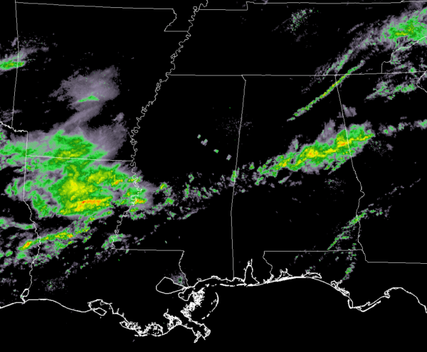
As of 8:20 am, we have this one batch of rain that is moving eastward just south of the I-20 corridor. It continues to shrink in size but if you are in the path of this batch, expect moderate to heavy rainfall for several minutes. It is moving quickly enough that major flooding problems are not expected, but some ponding and minor flooding may occur.
Much of the rest of North/Central Alabama is dry at this point with the exception of a small line of showers that is stretching from Ider to Blountsville. It is also moving at a good clip to the east. We’ve had some reports of gusty winds with this line, but well under severe criteria.
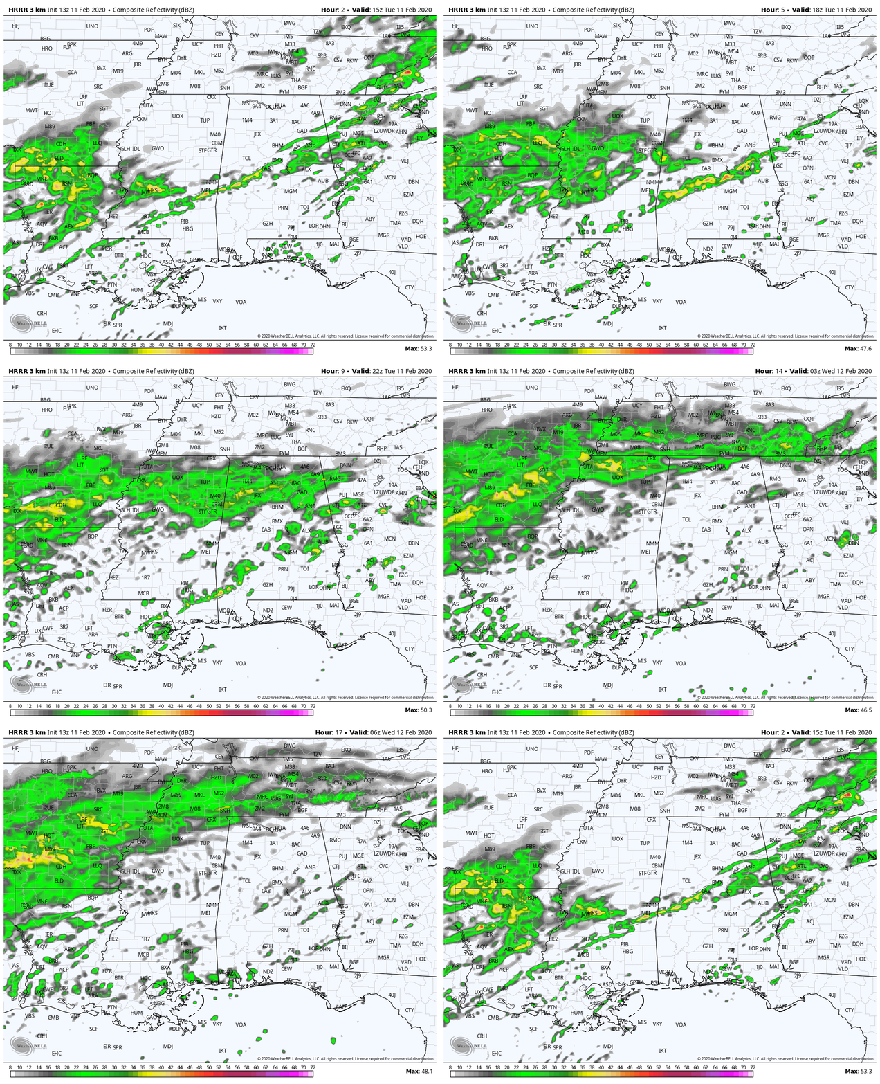
The latest HRRR shows much of the area staying dry through the rest of the morning hours except for the batch of showers that look to start growing back to the west-southwest and feeding off of the Gulf moisture. We’ll have more rain move in over the northern half of the area starting around midday and continue during the rest of the afternoon and evening hours. Those will start to lift northward and will mostly be in Tennessee by midnight tonight.
The good news is that it looks like the heavier rain is over for now, as the showers that move in later today will be light to moderate. Hopefully, this will give us enough of a window to allow any floodwaters to recede somewhat.
We’ll have updates if needed throughout the day today.



