


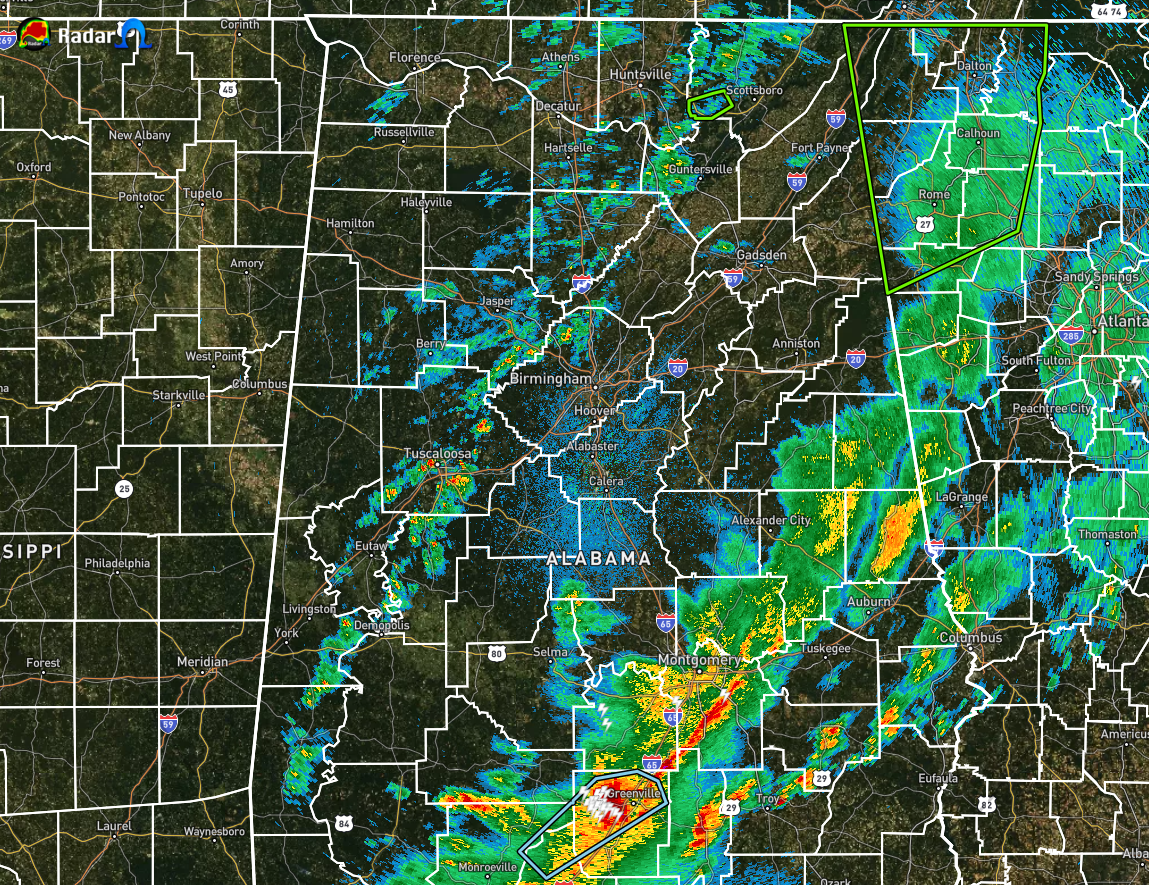
Radar is beginning to really quiet down across North/Central Alabama after a really busy day filled with tornado warnings and flash flooding. No warnings are currently active across the area except for a Flash Flood Warning for a small part of southeastern Jackson County in North Alabama, which is set to expire at 3:00 am.
The remaining part of the main line of rain and storms left in Alabama currently stretches from Wedowee to Wetumpka to Fort Deposit. It still may take a little while longer for this activity to move out of the area as the line is starting to become more tilted in orientation instead of the nearly vertical orientation it showed earlier.
We also have a band of numerous showers that has recently formed behind the main line that stretches from Hytop to Cullman to Tuscaloosa to just west of Demopolis. While this activity has recently formed, it is moving across an atmosphere that has been greatly worked over and much more stable. There may just be enough instability for a rumble of thunder with this line, but it is highly unlikely.
The Tornado Watch has been canceled for nearly every county in Central Alabama except for Pike and Barbour counties in the extreme southeastern parts of the area. While the threat for severe storms is much lower over those counties, there are enough ingredients remaining that a severe storm could form and a brief tornado may occur. The watch is scheduled to expire at 3:00 am. We’ll continue to watch what happens until then.



