


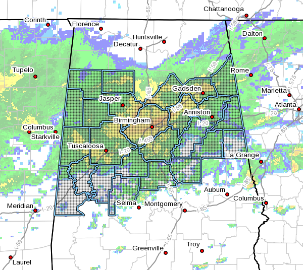
..FLASH FLOOD WATCH IN EFFECT FROM WEDNESDAY AFTERNOON THROUGH THURSDAY MORNING…
The National Weather Service in Birmingham has issued a
* Flash Flood Watch for portions of central Alabama, east-central Alabama, northeast Alabama, northwest Alabama, and west-central Alabama, including the following counties:
Bibb, Blount, Calhoun, Cherokee, Chilton, Clay, Cleburne, Coosa, Etowah, Fayette, Greene, Hale, Jefferson, Lamar, Marion, Perry, Pickens, Randolph, Shelby, St. Clair, Sumter, Talladega, Tuscaloosa, Walker, Winston
* From Wednesday afternoon through Thursday Morning
* Heavy rainfall with showers and thunderstorms will move into Central Alabama Wednesday night through Thursday morning associated with a cold front. An additional 1 to 1.5 inches of rainfall with isolated higher amounts are forecast, which may fall in a short period of time. Due to very saturated soil conditions and areal flooding still ongoing, flash flooding will be possible once again.
* Any heavy rainfall amounts in a short period of time will greatly enhance the risk of flash flooding due to already saturated soil conditions and rapid water runoff.
PRECAUTIONARY/PREPAREDNESS ACTIONS…
A Flash Flood Watch means that conditions may develop that lead to flash flooding. Flash flooding is a very dangerous situation.
You should monitor later forecasts and be prepared to take action should Flash Flood Warnings be issued.



