


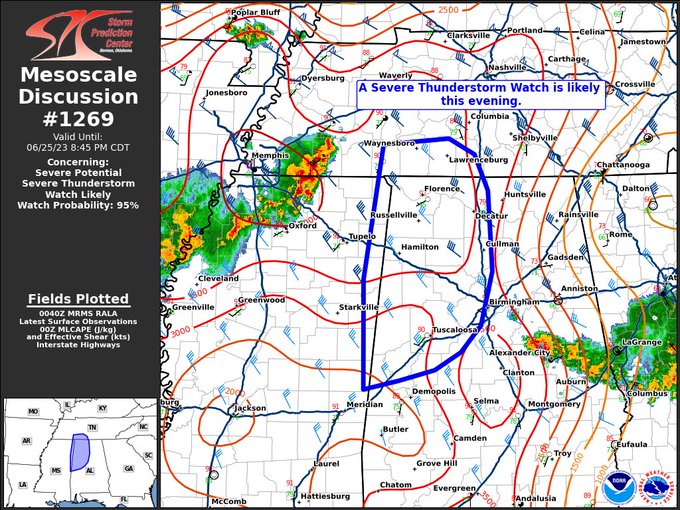
Probability of Watch Issuance…95 percent
SUMMARY… Thunderstorms upstream across northern MS and western TN will likely persist with a risk for significant damaging winds and hail. A new Watch is likely this evening.
DISCUSSION… As of 0040 UTC, regional radar analysis showed a well-developed cluster of severe storms moving across portions of western TN and northern MS. Ahead of these storms a broad unstable warm-sector remains mostly inhibition free across southern TN and western AL. Large buoyancy (3000+ j/kg of MLCAPE) and increasing vertical shear (40 + kt) are likely to support continued maintenance of the upstream cluster this evening. Hi-res guidance and reports of damage across western TN lend strong credibility to an increasing risk for damaging gusts (possibly 75+ mph) and hail into western AL and possibly southern TN this evening. The main severe threat should remain contained near/west of Interstate 65 to the east of which, outflow from previous storms has resulted in some stabilization. With the increasing risk for damaging winds and hail a new Severe Thunderstorm watch is likely this evening.



