


A fairly nice day after Christmas is in progress across Central Alabama. With a good supply of sunshine, tempreatures are warming a little faster than anticipated. By 11 a.m., readings were already near 50F in the I-20 corridor.
The noon readings are just in, and it is 52F at Birmingham. This is some 2-3 degrees ahead of where we thought we would be, so highs in the middle 50s look likely.
There is abundant sunshine despite a thin layer of cirrus clouds and plenty of jet contrails. Increasing jetstream level moisture flowing from the southwest is responsible for this.
High pressire is increasing to our west and this is giving us a freshening northerly flow and a new supply of cool dry air.
The high clouds will be with us overnight. Lows will drop into the middle and upper 20s.
Tomorrow will feature increasing clouds with highs again in the 50s. It should become cloudy tomorrow night in advance of the next system, that will bring rain on Saturday.
The morning run of the GFS is consistent with the last few runs, showing a soaking rain developing Saturday for Central Alabama with 1 to 2 inch amounts possible. We do note that the NAM is a little slower and little further southeast with the heavier rain, keeping the heaviest mainly over Sotheast Alabama.
The morning run of the European is out far enough to see the entire evolution of the next system, and it seems to be siding with the NAM on a more southeasterly track and displacement of the heaviest rain over Southeast Alabama. It would mean rain would not start until afternoon in Central Alabama and amounts would be a little less.
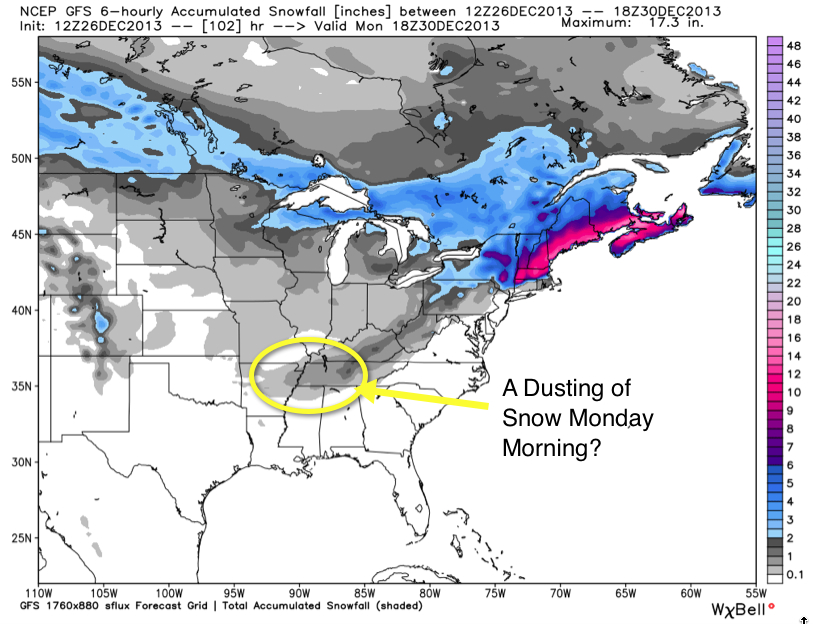
Interesting note: both the European and the GFS depict an area of light snow developing over Arkansas and western Tennessee Sunday night and moving across North Alabama early Monday. This could make for a dusting of snow in some spots early Monday, and some flakes in others. We will be watching this development!



