


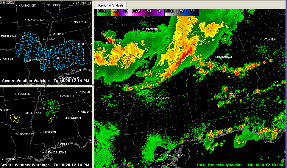
A line of strong storms extends now from Marion County across northern Lamar County and southeastward into eastern Mississippi.
The NWS Jackson has issued a severe thunderstorm for Lowndes County MS (around Columbus).
A new severe thunderstorm warning was just issued for Fayette and Lamar Counties in West Alabama.
These storms will continue southeastward into very unstable air with CAPEs running 3000-4000 j/kg across the area from southern Lamar and Fayette through Tuscaloosa into Shelby, Talladega and Coosa Counties and points south. An outflow boundary with a few heavy showers along it extends southeast from Fayette through northern Tuscaloosa, northern Bibb southern Shelby and northern Chilton Counties. The greatest threat of severe weather will be south of this boundary.
A severe thunderstorm watch remains in effect until 6 p.m. for much of West and Central Alabama. The northernmost counties in the watch include Lamar, Fayette, Walker, Jefferson, Shelby and Coosa Counties.
Very heavy rain is falling across almost all of Marion and northern Lamar Counties. Flash flood warnings cover most of these counties now.
Heavy rain will spread across much of Winston, Walker and into Jefferson Counties over the next few hours as well.



