


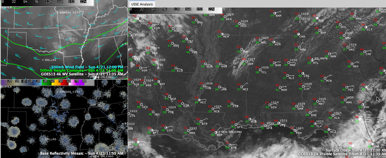
There was some great sleeping weather early this morning across Central Alabama, with temperatures in the 40s. There were even a couple of 30s in the record this morning, including 38F in Anniston, 36F at Troy and 34F at Fort Payne. The two winners in the chilly parade though were 32F at Valley Head and 33F at Russellville. Once again, you could clearly see that we aren’t a one number forecast here in Central Alabama, with 45F at Birmingham. Hope you had the windows wide open.
A good looking Sunday is in progress across Central Alabama. After a chilly start mainly in the 40s, temperatures will warm back into the upper 60s to lower 70s this afternoon.
The few clouds that were across the area this morning are moving out with the disturbance that produced them, leaving mostly sunny skies in their place. The exception is over Northeast Mississippi and Northwest Alabama, where patches of high clouds are giving the sky a little character.
To the west, a big upper level trough is dominating the country today. The axis of the trough now extends down the middle of the country from the Dakotas to Texas. Troughs are usually associated with bad weather, but this one is pretty tame. It is producing showers across the Plains states and Midwest, including parts of Nebraska, Iowa, Kansas, Oklahoma, Missouri and Arkansas. That trough will mean more clouds over the next couple of days, but not enough to totally block out the sun.
There could even be an isolated shower on Monday as the trough axis moves closer and moisture levels start to increase on the back of an increasing easterly and southeasterly wind. There could even be a tiny bit of instability by Tuesday afternoon, but it probably won’t be enough to trigger any thunder.
The next chance for rain and storms will come late Tuesday night over northwestern sections, proceeding slowly southeastward during the morning and into areas east of I-59 by afternoon. There could be some severe weather Wednesday afternoon during the heating of the day over eastern and South Central Alabama ahead of the cold front, but it doesn’t look like it will be significant.
We do note that the morning run of the GFS Is even slower than previous run, and slower than the overnight European, with the storms getting into the I-59 corridor during the afternoon. This could make them a little stronger. The GFS also hints that it could stall in the area through much of Thursday, keeping rain in the picture then.



