


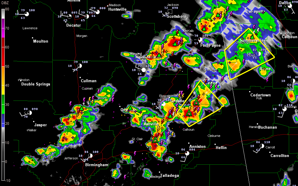
Thunderstorms continue over North Central and Northeast Alabama this afternoon, generally east of a line from the Bankhead Lock and Dam to Cordova to Hanceville, Holly Pond and Guntersville.
The back edge is moving slowly eastward ahead of an approaching cold front/dry line.
The most intense storms are over Northeast Alabama. A severe thunderstorm warning is in effect until 2:45 for Calhoun, Cherokee and Etowah Counties.
Expect copious amounts of lightning with all the storms along with gusty winds and heavy rain. Hail will be a standard feature with most of them, and large hail will be a problem with the bigger storms.
A severe thunderstorm watch remains in effect for much of the area to the east of the aforementioned line until 5 p.m. Additional strong to severe storms will overspread East Central Alabama from the south through the afternoon.



