


Daily Weather Briefing
Saturday, August 15, 2026
ALABAMA THIS MORNING
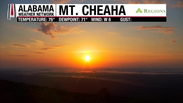
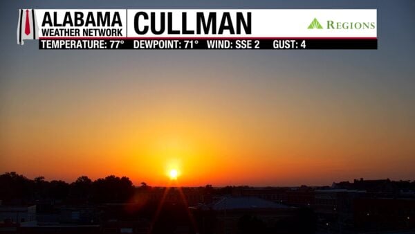
Skies are mostly clear this morning, with a few clusters of clouds over central and south-central Alabama. No rain greets us, and temperatures sit in the 70s across the state. Our Regions Skycams on Mt. Cheaha and in Cullman display breathtaking sunrise views to start our Saturday morning!
ALABAMA 7 DAY FORECAST
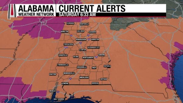
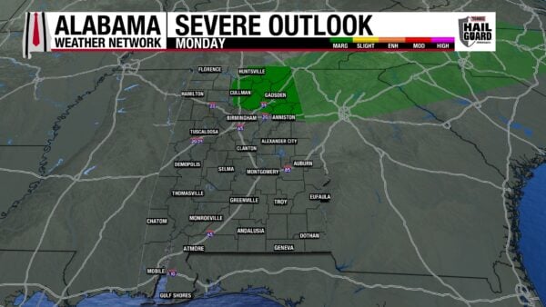
The heat keeps its grip on Alabama this weekend and most of next week as the upper-level ridge sits over the Southeast with little plans of moving. Southeast Alabama has a low-end severe weather threat this afternoon, and northeast Alabama has one Monday afternoon. A Heat Advisory is in effect statewide at least through the weekend.
HOT AND HUMID THIS WEEKEND – Aug 15-16
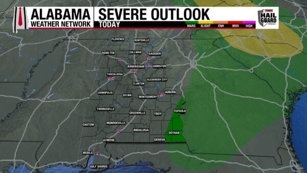
We are familiar with this pattern by now: warm and muggy mornings, heating up throughout the day, isolated afternoon thunderstorms. That is the case for today, with highs reaching the upper 90s across most of the state. West Alabama will see a few locations breach 100 degrees, while east Alabama sticks closer to the mid 90s. Moisture is more than present, and that will be clear with humid conditions that cause feels-like temperatures to rise into the 105–112-degree range, with isolated locations possibly hitting 113 or 114 degrees. Isolated afternoon thunderstorms will develop today, favoring east/southeast Alabama. Storms that develop in the far southeast corner of the state have a Marginal Risk (1/5) of becoming severe and producing damaging winds, frequent lightning, and heavy downpours. This includes east Geneva, east Dale, east Barbour, east Russell, Henry, and Houston Counties. Storms look to persist until late evening.
Tomorrow will see no severe weather risk, just typical afternoon thunderstorms. Highs will hit the upper 90s statewide, with a slightly larger spread of temperatures that hit or exceed 100 degrees. Feels-like temperatures will again sit from 105-112 degrees.
HEAT CONTINUES NEXT WEEK – Aug 17-18
It will be hot and humid on Monday and Tuesday as well, as the upper-level ridge does not budge.
Highs on Monday will range from the upper 90s to around 100 degrees again; feels-like temperatures will be the same as this weekend’s. Afternoon isolated thunderstorms are expected statewide, and northeast Alabama has a Marginal Risk (1/5) of Severe Thunderstorms as a frontal boundary is expected to push through north Alabama sometime Monday. Counties from Cullman County to the Georgia state line and from the Tennessee state line to most of St. Clair and Calhoun Counties are included in this risk. Any severe storms that develop could produce damaging winds, frequent lightning, and heavy downpours.
Tuesday’s highs will be in the mid to upper 90s, and west Alabama will still be capable of a 100-degree reading or two. Feels-like temperatures will still be oppressive in the 105-112-degree range, and showers and thunderstorms will be isolated in the afternoon.
HEAT LESSENS SLIGHTLY TO END NEXT WEEK – Aug 19-21
Wednesday through Friday will still be hot and humid, but the possibility of 100-degree highs seems to diminish. This is due to the ridge’s slow movement westward over the period.
On Wednesday, the highs will be in the mid to upper 90s across the state, and a 20% chance of isolated thunderstorms is expected.
Little change is expected Thursday.
Friday might be slightly more bearable as highs will mostly stay in the low to mid 90s, although an upper 90-degree reading stays possible in the west/southwest. Rain chances increase to 30% statewide as well.
RAINFALL OUTLOOK
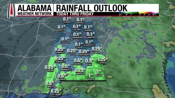
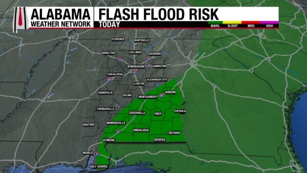
The southern half of the state is really the region that will get any rain this week, as it expects a quarter of an inch to an inch of rain. The northern half of the state is not expecting more than a tenth of an inch of rain, even with the storms expected in the northeast on Monday. There is a Marginal Risk (1/4) for Flash flooding across much of the south today, excluding southwest Alabama. The storms may be efficient rainfall producers and cause flooding in low-lying and poorly drained areas.
DROUGHT IMPROVING IN THE NORTH, WORSENING IN THE SOUTH
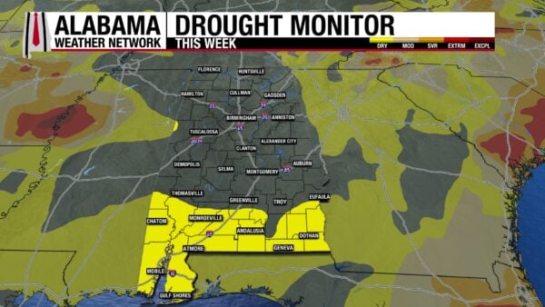
Regarding Alabama’s drought, there is good news and bad news. The good news is north Alabama is drought-free! Most of central Alabama is as well, with just a bit of western Pickens County experiencing Abnormally Dry (D0) conditions. Unfortunately, though, the Abnormally Dry conditions that south Alabama was experiencing last week have expanded. Last week, 18.37% of the state saw Abnormally Dry conditions, and that percentage increased to 23.13%. Hopefully, some of the rain we’re expecting in the south will help out.
WATCHING THE ATLANTIC AND PACIFIC
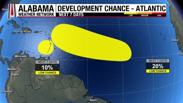
The Atlantic seems to be putting the areas of low-pressure outlooked for tropical development through the wringer as of late. The area of low-pressure in the western Atlantic, Invest 92, has only a 10% chance of development over the next seven days as upper-level winds and dry air have increased. Although tropical development is unlikely, the area is producing gusty winds and tropical downpours, and the Lesser Antilles can expect these conditions today. The other invest, Invest 94, has a 20% chance of development as it is also expected to run into upper-level winds and drier air later in the period. Strong upper-level winds and dry air are not conducive to tropical development.
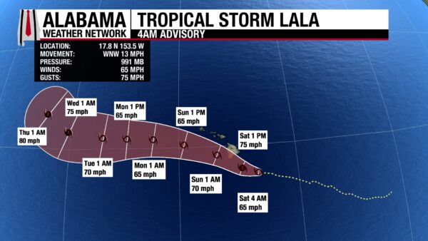
The Pacific has a lot going on. Tropical Storm Lala, with sustained winds of 65 mph and a central pressure of 991 mb, is forecast to become a Category 1 hurricane this afternoon, shortly before the core of the system moves over the South Point of the Big Island tonight. The storm will produce hurricane-force winds, 10-20 inches (locally higher) of rain that will produce land and mudslides, 1-3 feet of storm surge, and large swells across much of the Big Island today. Tropical Storm conditions are possible across the small islands tomorrow.
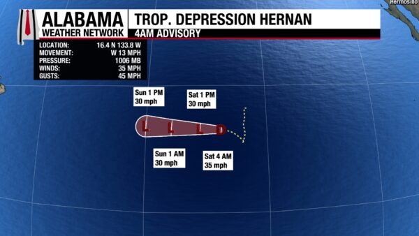
Additionally, Tropical Storm Hernan has weakened to a tropical depression with sustained winds of 35 mph and a central pressure of 1006 mb. It will move west over the rest of the weekend and will keep sustained winds of around 30 mph as it does so.
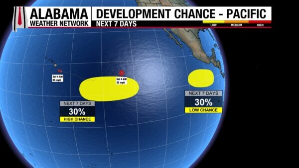
There are also two areas of interest or invests; the National Hurricane Center is watching in the Pacific. One sits south of Hernan and has a 30% chance of development over the next seven days as it moves westward. The other sits off the Mexican and Central American coast and has a 30% chance of development too.
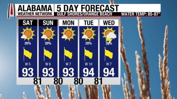
GREAT SUMMER BEACH WEATHER PERSISTS
Conditions on the Alabama Gulf Coast will be quite typical, and enjoyable, for this time of year. Today’s high will be in the low 90s, with mostly sunny skies, a Very High UV Index, and winds from the west around 5 mph. There is a 20% chance of an afternoon thunderstorm beachgoers will have to avoid, but otherwise, conditions are great. The rip current risk remains Low, and the surf height is only around 1 foot. These conditions persist through mid-week.
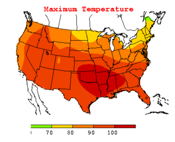
TODAY IN WEATHER HISTORY
August 15, 2007 – Ten Days Above 100
A powerful upper-level ridge settled over the Southeast during August 2007, trapping Alabama beneath sinking, warming air and suppressing the clouds and thunderstorms that normally provide occasional summer relief. The heat arrived during an exceptional drought, with parched ground and vegetation stretching across much of the state. The most intense portion of the heat wave lasted from August 7 through August 16, when Birmingham reached or exceeded 100°F for a record 10 consecutive days.
August 15 became one of the heat wave’s most remarkable days. Birmingham reached 105°F, establishing a new August record and marking its 9th consecutive day at or above 100°F. The streak continued for one more day, reaching a record 10 consecutive days. Huntsville also reached 105°F, Tuscaloosa climbed to 106°F, and Muscle Shoals and Pinson each recorded 107°F. Moundville and Fayette reached 108°F, while a station at Hamilton reported 109°F.
The records extended well beyond one afternoon. Birmingham recorded 14 days at or above 100°F during August, surpassing its previous monthly record of 12. Montgomery endured 12 consecutive triple-digit days, Tuscaloosa recorded 11, and Pinson reached 100°F or higher on 17 days during the month. The broader heat wave lasted roughly three weeks, with record high temperatures continuing to be broken through August 24 as the upper-level ridge remained anchored over the region.
The prolonged exposure took a serious human toll. National Weather Service researchers attributed 13 deaths to Alabama’s August heat wave. Nearly 700 people received treatment for heat-related illness, and 164 required admission to hospitals. Most of those treated were working-age adults who became ill while working outside, while many who died were elderly people who lived alone and lacked air conditioning.
The heat also intensified Alabama’s ongoing drought and wildfire danger. The Alabama Forestry Commission placed much of the state under fire alerts or drought emergencies for extended periods. During 2007, more than 3,300 wildfires burned approximately 70,000 acres statewide. Birmingham finished the year with only 28.86 inches of rain, making it the city’s driest year on record at the time.
The August 2007 heat wave did not arrive with violent winds, thunder, or dramatic skies. Instead, its danger accumulated quietly as one triple-digit afternoon followed another, leaving people, homes, and workplaces with little opportunity to recover. Alabama’s experience demonstrated that the duration of extreme heat can be just as important as the highest temperature reached.
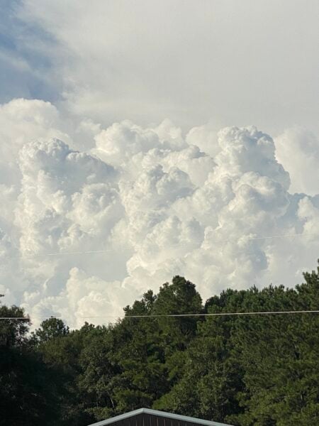
IMAGE OF THE DAY
Skywatcher James Micetich captured an awesome photo of a cumulonimbus cloud east of Fadette yesterday afternoon!



