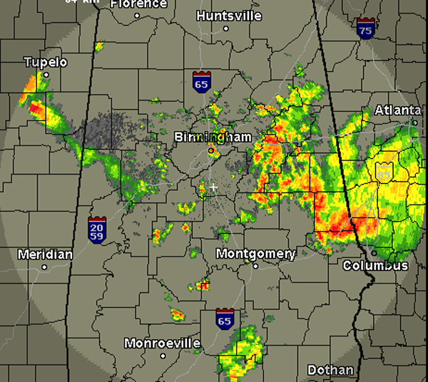
A busy night across Central Alabama as some severe weather developed and lasted for several hours. The severe weather threat diminished through out the night but a flooding threat developed. A mid-level trough along with ample moisture transport from the Gulf of Mexico and the development of a low-level convergence zone has led to persistent showers and thunderstorms developing over the same region. Areas from Birmingham east along Interstate 20 have seen several inches of rain this morning. Several flash flood warnings are in effect as a dangerous flash flooding event is ongoing.
These showers and storms appear to be winding down slowly and weather conditions should be improving through out the morning. Additional showers and storms are expected later today.