Daily Weather Briefing
Sunday, October 18, 2026
ALABAMA THIS MORNING
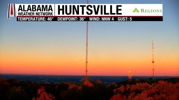
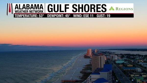
It’s a crisp morning for parts of north Alabama as they reach 39 degrees, while the rest of the state wakes up to chilly temperatures in the low to mid 40s in north-central and central Alabama and the mid to upper 40s in the south. Coastal Alabama ranges from the upper 40s to low 50s. Skies are mostly clear with gorgeous sunrises occurring statewide, as seen on our Regions Skycams in Huntsville and Gulf Shores.
ALABAMA 7 DAY FORECAST
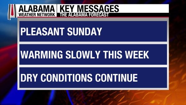
Another pleasant fall day is on tap in Alabama as cool and dry conditions persist for another day. An upper-level ridge to our west and a building upper-level trough to our east will keep up in dry northerly flow with warming temperatures through the week.
PLEASANT SUNDAY – Oct 18
Pleasant conditions are expected statewide today after a chilly morning, as highs will rise to the upper 60s and low 70s. Breezy conditions will continue in the south at 10-15 mph, gusting to up to 25 mph.
SLOW WARMING STARTS THE WEEK – Oct 19-21
The upper-level ridge mentioned above will allow highs to increase slowly each day this week, and the northerly flow will keep our state dry.
On Monday, highs will rise to the lower 70s after a morning in the low 40s north and mid 40s south.
Tuesday morning, temperatures will be in the low to mid 40s from north to south again, then highs will climb into the mid 70s statewide.
Wednesday won’t be as chilly in the morning, with lows in the mid 40s north and mid to upper 40s centrally and in the south. The coast will be in the mid 50s. Highs will range from the mid to upper 70s over Alabama.
WARMER END TO THE WEEK – Oct 22-24
Temperatures will continue to increase each day slowly into the end of the week, and although we’ll see the low 80s return, these warmer temperatures will not feel oppressive thanks to the absence of humidity.
Thursday’s highs will see the return of 80-degree temperatures for parts of the state, while the upper 70s mix in as well.
Friday and Saturday’s temperature spread will be very similar to Thursday’s.
RAINFALL OUTLOOK
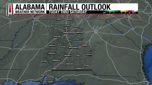
Alabama will be completely rain-free this week.
TROPICS
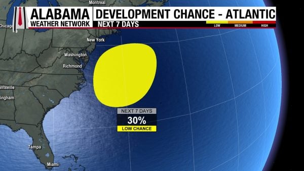
A subtropical low-pressure system is expected to form off the Southeast coast later today or tonight, then move erratically up the coast throughout the week. Some development through the middle of this week (30% chance), but regardless of development, this system will produce gusty winds, coastal flooding, and dangerous surf along the East Coast.
BREEZY SUNDAY BEACH DAY
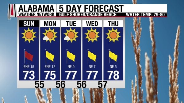
Winds will blow from the northeast at 15 to 20 mph today, so conditions will be breezy, and the rip current risk is High with a surf height of 3 to 5 feet. Skies will be sunny, the high will be in the mid 70s, and the UV Index will be High. Marine conditions should begin to calm down tomorrow, and similar conditions of highs in the 70s with sunny skies will persist this week.
WEATHERBRAINS 1083
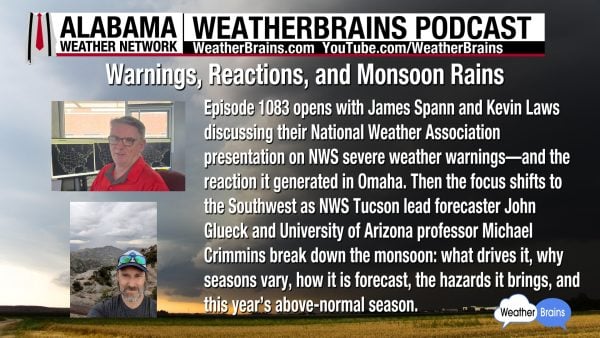
Tomorrow’s WeatherBrains episode features a chat with James Spann and Kevin Laws about their National Weather Association severe weather warnings presentation, as well as John Glueck and Michael Crimmins to discuss the monsoon. Listen to the episode wherever you get your podcasts or listen here!
TODAY IN WEATHER HISTORY
October 18, 1990 – East Coast Tornado Outbreak
On October 18, 1990, an extraordinary outbreak of tornadoes swept across the eastern United States, turning an otherwise ordinary autumn Thursday into a day of destruction from North Carolina to southern New England. A powerful storm system advancing eastward drove a strong cold front into unusually warm, humid air flowing northward from the Atlantic Ocean. The combination created an atmosphere capable of producing violent thunderstorms far beyond the regions most commonly associated with major tornado outbreaks. As storms erupted along and ahead of the front, damaging winds, torrential rain, and tornadoes spread across seven states. By day’s end, 16 tornadoes had been confirmed, including four rated F3 on the original Fujita Scale, capable of devastating damage to homes and other structures.
The outbreak began taking shape across Virginia and North Carolina, where some of the day’s strongest tornadoes developed. An F3 tornado struck Union County, North Carolina, while another tore through Orange County, Virginia, cutting a path approximately three and a half miles long. The storms intensified as they moved northeastward, striking communities with little time to react. In King William County, Virginia, tragedy unfolded in the rural Mount Olive community when a powerful F3 tornado struck a farm belonging to 73-year-old Russell L. Martin. The tornado destroyed his barn, killing him beneath the wreckage. The tornado’s documented track extended approximately five miles, with a recorded average width of 430 yards. Martin would be the only person killed in the outbreak, a stark reminder that even a relatively brief tornado can have devastating consequences.
Farther north, one of the day’s most destructive tornadoes struck Reisterstown, Maryland, northwest of Baltimore. The F2 tornado ripped through a residential area, tearing roofs from buildings, damaging an apartment complex, overturning vehicles, and scattering debris through neighborhoods. Approximately 50 homes were torn apart or badly damaged, and 59 people were injured, making it the outbreak’s most injurious tornado. Eighty-year-old resident Alverta Payne survived after the roof of her home collapsed around her. She later described the terrifying moment to reporters: “All of a sudden, the whole roof caved in.” Payne escaped by crawling through the wreckage of her third floor. Fourteen ambulances were dispatched to the devastated area as emergency crews searched damaged buildings and assisted the injured. The surrounding storms also disrupted electrical service to tens of thousands of customers, leaving neighborhoods facing the approaching evening without power.
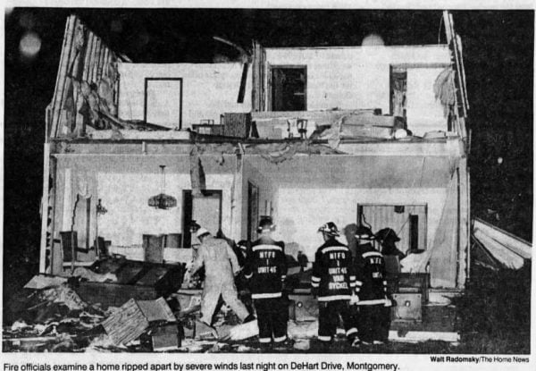
The violence continued into New Jersey, where an F3 tornado touched down in Montgomery Township in Somerset County during the early evening. Developing along a fast-moving line of thunderstorms, the tornado remained on the ground for only about half a mile, but its concentrated destruction was extraordinary. On DeHart Drive in the Belle Mead area, three homes were flattened and 21 others damaged. Eight people were injured, including a young girl who survived after being thrown from her home by the tornado’s powerful winds. Despite suffering serious injuries, she was expected to recover. The tornado left behind a narrow corridor of shattered houses, uprooted trees, and scattered belongings, demonstrating how quickly a violent tornado could devastate a neighborhood.
Beyond the tornado tracks, the larger storm system battered the densely populated Northeast with destructive straight-line winds and heavy rain. At Newark International Airport, powerful winds broke windows, damaged automobiles, and injured people in the surrounding area. In Washington, D.C., driving rain and violent gusts swept across the Capitol grounds, shredding flags above congressional office buildings. Water even entered the Capitol Rotunda, forcing workers to protect statues with plastic coverings. In Rhode Island, a wind gust of 115 mph was reported at Westerly, demonstrating the extraordinary intensity of the broader storm system. From flooded streets and uprooted trees to damaged airports and shattered homes, the severe weather disrupted daily life across a vast stretch of the Eastern Seaboard.
By the time the storms moved offshore, the October 18 outbreak had produced 16 confirmed tornadoes across North Carolina, Virginia, Maryland, Delaware, New Jersey, New York, and Rhode Island. Six reached F2 intensity or greater, including four rated F3. The tornadoes killed one person and injured 76 others, with substantial property losses across the region. The outbreak was especially noteworthy for its October timing, geographic reach, and concentration of significant tornadoes in areas more accustomed to coastal storms than violent tornadic thunderstorms. It demonstrated how a powerful autumn weather system, drawing on Atlantic moisture and strong upper-level winds, could produce an outbreak resembling those more often associated with springtime. For the families in Reisterstown, Montgomery Township, and rural Virginia, however, the event was remembered not simply for its meteorological rarity, but for the terrifying minutes when homes disappeared, familiar neighborhoods were transformed, and ordinary lives changed forever.
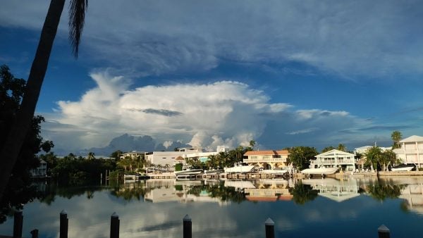
IMAGE OF THE DAY
Skywatcher Mechete Pittman sent this amazing photo of clouds associated with the cold front (that came through Friday) in the Florida Keys yesterday evening.