


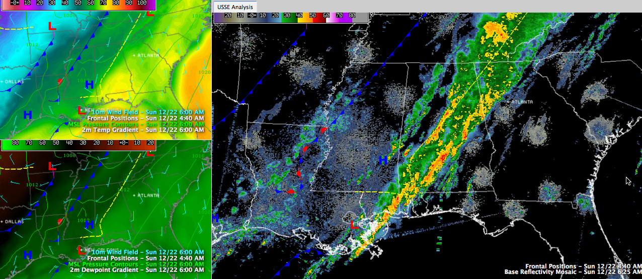
The Internationally Beloved Meteorologist, Brian Peters, will be along with his excelletn morning WeatherXtreme video shortly, but here is an update just before 6:30.
This morning, a prefrontal trough lies in the vicinity of I-59. Cooler and drier air has filled in behind this trough with temperatures in the 50s. Ahead of the trough, it was in the 60s and 70s. It’s 76F still at Alex City.
Showers and storms are extend from the trough back about 50 miles to near I-59 at 6 a.m. More heavy rain and storms are in the Montgomery area. They are not severe, but can’t rule out an isolated warning with some rotation possible due to leftover shear along and ahead of the boundary. Good bit of moderate to heavy rain and some lightning extending from St. Clair through Shelby into Bibb and Perry Counties. Certainly not severe, but a few rumbles of thunder greeting the day.
More showers have developed over West Alabama’s Sumter, Greene, Pickens and Tuscaloosa Counties.
The first frontal boundary is lying to the northwest from near Hopkinsville KY to Greenwood MS to Alexandria LA. This front has lost its forward momentum and will basically stall for a time today waiting for a second frontal system that’s back near Hot Springs and Texarkana AR.
Heavy rain will continue today in the I-85/I-65 corridor for places like Lafayette, Auburn, Montgomery and Greenville, pushing into Southeast Alabama later today. 2 inches or so of rain is possible.
A few more showers will develop later today across Central Alabama in advance of the main front. But they should be mainly light.
The main front should sweep through the state late tonight and set the stage for a cool but dry holiday week.



