


Yeah, I know a guy “on vacation” shouldn’t be posting at 4:30 a.m…. but I am up early about to head out on a trip, and thought I would peek at the cold coming next week. No change… still looks like a setup for highs in the 30s (Tuesday), and lows in the teens (Wednesday morning). Here is the output of the FIM valid at midday Tuesday, showing temperatures only in the 30s almost down to Mobile… with 20s over northeast Alabama…
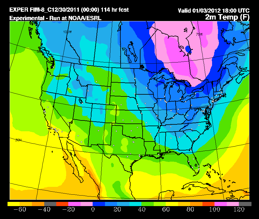
And, even the dreaded GFS MOS is catching up now, showing a high of 42 Tuesday (which looks too warm), and a low of 19 early Wednesday. We can be much more specific about the numbers over the weekend. As usual, the European model has performed much better at the medium range with this event.
It will be a quick hitting cold shot, with warmer weather returning later in the week. Remember, Brian is working the TV morning shift, meaning the discussion and video will come along a little later than usual. I will be back at my post Tuesday of next week. Headed off to the mountains of West Virginia this morning with a youth group from my church. I hope I come back alive…



