


All day, we have been tracking a mesoscale convective system as it formed over Arkansas and pushed slowly southeastward. The system started weakening a couple of hours ago as it traversed western Tennessee and northern Mississippi, puffing out a big outflow boundary that preceded it.
Now that boundary is triggering new storms tonight as it runs into other outflow boundaries from storms earlier today over Alabama. The models didn’t handle this very well, predicting everything would die down late this evening.
The good news is the storms shouldn’t be severe, although they could produce gusty winds along with the standard heavy rain and lightning.
Here’s the radar at 10:15:
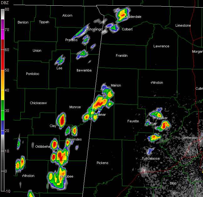
Storms in southern Walker County may drift down into extreme western Jefferson County. John Talbot is hearing distant thunder at his location in Hueytown/Concord.
Storms in Lamar County have gained strength, and will increase a bit more as the main outflow from the Mississippi complex arrives in a while. They are building into Marion County and moving toward Fayette County.
Hopefully all these boundaries will make the models eat crow again on Sunday. Right now we are calling for lesser storm chances on Sunday, but the devil is in the details…the mesoscale details that is…and we probably won’t be able to discern them until tomorrow morning.
Hope you get some rain overnight. South of I-59, that looks unlikely…but we can hope.



