


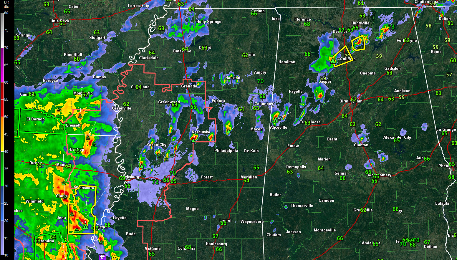
Scattered strong storms continue late this afternoon across northeastern Mississippi, North and North Central Alabama.
There is a severe thunderstorm warning right now for eastern Morgan and western marshall Counties. The storm is northwest of Arab, heading in the general direction of New Hope.
A strong storm is southeast of Addison. It is heading for Cullman. It shows signs of small hail. A severe thunderstorm warning was just issued for parts of Cullman and Morgan Counties.
A storm east of Berry is moving in the direction of Sumiton in Walker County. This storm will cross northern Jefferson County in the vicinity of Warrior and Trafford.
A storm in northern Pickens County is moving toward Reform. There is probably small hail in that storm.
In eastern Mississippi, strong storms are lined up from near Louisville to south of Kosciusko to northeast of Vicksburg.
There are no storms threatening Tuscaloosa, Birmingham, Gadsden or Anniston at this hour. The storms over Pickens County may get into northwestern Jefferson County eventually.
All of the storms will have gusty winds, heavy rain, and dangerous lightning.
A large mass of rain and storms covers much of the state of Louisiana. This activity is moving into southwestern Mississippi. A funnel cloud was sighted just before 5 p.m. at Woodville MS. That is south of Natchez.



