


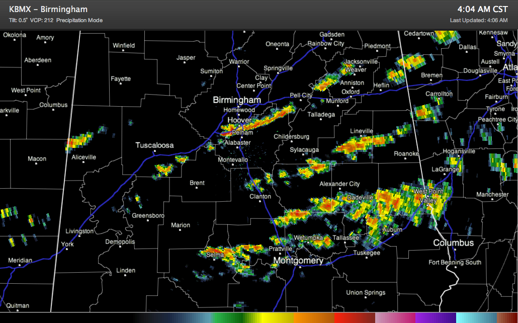
Moderate to heavy showers continue across central Alabama this morning, well south of our main line of storms and cold front.
They are mainly southeast of I-59. Some of the main concentrations of showers are over northern Shelby into southern St. Clair County, from Selma to Montgomery to Auburn and south of Alex City. This activity isn’t tall enough to support lightning yet for the most part, but it will produce brief very heavy rainfall. Tops are approaching 35,000 feet in northern Shelby County though, and we could see lightning soon from these cells.
The main line of storms should reach Marion County after 5:30, Walker County by 7 and Birmingham by 10 a.m. Those times are rough approximations. There have been several indications of bowing segments in the line, which can result in 50-60 mph winds that can cause damage.
Still waiting to see what the SPC will do with the watch. It most likely will be extended southeastward into Central Alabama. I would imagine it will also be a tornado watch.



