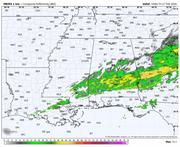
RADAR CHECK: A large area of rain is over the southern half of Alabama early this morning, moving slowly southward. Most of the rain should be out of the state by midday as drier air creeps in from the north. Expect a high in the 68-74 degree range today for most communities.
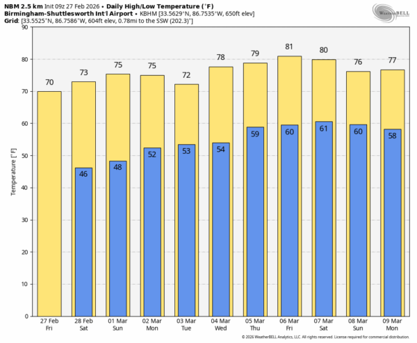
Alabama’s weekend will be very mild and mostly dry. Just a small risk of a shower around Dothan tomorrow, otherwise rain-free weather for the state with partly to mostly sunny days and fair nights. Highs will be in the 70s; a few spots across South Alabama could touch 80 degrees Sunday.
NEXT WEEK: A strong upper ridge will build over the Southeast U.S. next week, and that will keep the rain producers west and north of Alabama. The weather will be generally dry and warm with highs in the 70s Monday and Tuesday, and in the 76-84 degree range over the latter half of the week. See the video briefing for maps, graphics, and more details.
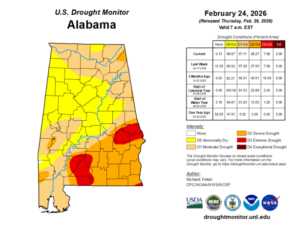
DROUGHT MONITOR: The new drought monitor was released yesterday; 67 percent of Alabama is some kind of drought. Unfortunately it looks like we won’t have any meaningful rain over the weekend and through next week.
YESTERDAY: Thunderstorms “over performed” yesterday across Alabama. Some of the storms featured large hail and strong winds. It is likely a small tornado touched down in Pinson, and possibly in Trussville; NWS Birmingham will do a storm survey this morning in both spots.
ON THIS DATE IN 2010: A magnitude 8.8 earthquake occurred off the coast of central Chili at 3:34 local time. The quake triggered a tsunami that devastated several coastal towns in south-central Chile. Tsunami warnings were issued in 53 countries. In addition, waves caused minor damage in the San Diego area and the Tohoku region of Japan.
I am traveling again today so no afternoon video briefing, but I will post fresh forecast notes here by 3:00 this afternoon…