


An all new edition of the ABC 33/40 Weather Xtreme video is available in the player on the right sidebar of the blog. You can subscribe to the Weather Xtreme video on iTunes by clicking here.
WET WEATHER ON THE WAY: The daytime hours today will stay dry, although clouds will increase this afternoon ahead of a developing storm system to the west. We reach the mid 50s this afternoon as the clouds begin to move in.
TIMING: Rain will move into West Alabama tonight in the 9:00-10:00 time frame, and becomes widespread over the northern half of the state after midnight. Some of the heaviest rain will come while you are sleep during the pre-dawn hours tomorrow.
The models continue to trend a little faster, and show the rain ending late tomorrow morning. We will now forecast the main 12 hour window for rain to be from 10:00 tonight through 10:00 a.m. tomorrow. A little thunder is possible, but doubtful, and there is no risk of severe weather. Just lots of rain.
Tomorrow afternoon will be dry, but the clouds will linger through the day. The high tomorrow afternoon will be near 60 degrees.
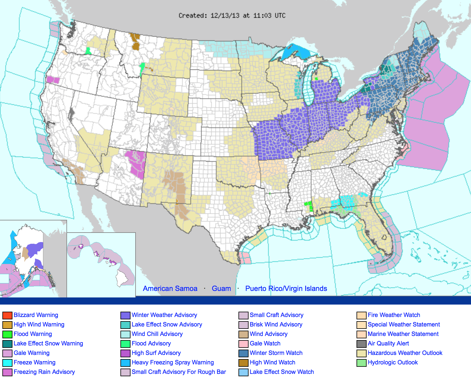
TO THE NORTH: The storm system that will bring rain to our state, will put down snow from Missouri over to New England over the weekend. If you are headed up that way, be ready for some snowy conditions.
COLDER SUNDAY: A new surge of cold air drops in here Sunday; the day will be windy and cold with a high only in the mid 40s, and a north wind of 10-20 mph will make it feel colder. Clouds will linger into Sunday morning, but we will forecast gradual clearing during the afternoon as drier air works into the state. Temperatures will drop into the 20s by early Monday morning.
NEXT WEEK: Looks quiet and dry; highs well into the 50s, and lows mostly in the 30s Tuesday through Friday morning. We might even touch 60 degrees late in the week. But, a new surge of very cold, Arctic air will be charing up while our weather is quiet.
CHRISTMAS WEEK: The GFS brings in a good rain event on Saturday December 21, followed by much colder air on Sunday December 22, which lasts through much of Christmas week. There is no real skill in a specific forecast out here, but the idea of a cold Christmas week looks very solid. We just don’t know how cold at this point.
And, just for fun, the 06Z GFS brings a short wave into the Deep South Christmas Day. But, this is all voodoo for now. See the Weather Xtreme video for the maps, graphics, and details.
WEATHER BRAINS: Don’t forget you can listen to our weekly 90 minute netcast anytime on the web, or on iTunes. This is the show all about weather featuring many familiar voices, including our meteorologists here at ABC 33/40.
CONNECT: You can find me on all of the major social networks…
Facebook
Twitter
Google Plus
Instagram
Look for the next Weather Xtreme video here by 4:00 or so this afternoon. Enjoy the day!



