


Just had to tinker with the forecast based on the morning data. A few notes:
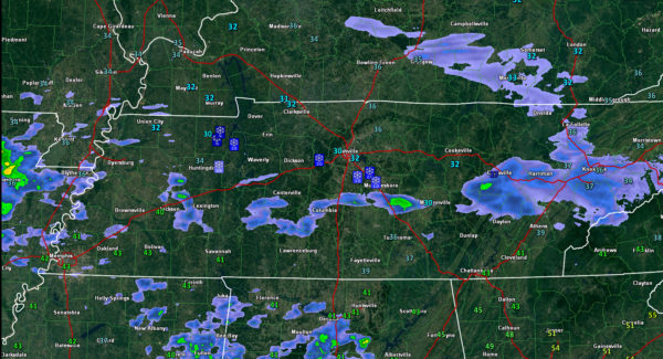
…It has been a snowy morning in Middle Tennessee. 1-3 inches of snow fell during the early morning from Paris to Nashville. Temperatures have edged above freezing in the Music City now. Roads stayed pretty clear since ground temperatures have been so warm. The snow accumulated mainly on roofs.
…The NWS in Huntsville just issued a winter weather advisory for tonight for their Tennessee Counties (not for any of their Alabama counties). This is clearly in line with the GFS. Its morning run shows a decent cold rain in the I-20 Corridor tonight with some light freezing rain/snow across northern parts of Lauderdale, Limestone, Madison and Jackson Counties.
…Much of southeastern Tennessee and extreme northern Georgia now has a winter weather advisory for tonight into early Sunday. A winter storm warning is in effect for the mountains on eastern Tennessee and western North Carolina.
…As I said, we are on track for a decent cold rain tonight. Amounts should average between one quarter and one half inch. Lows will be in the middle 30s over North Central Alabama with upper 30s to near 40F in the I-20 Corridor.
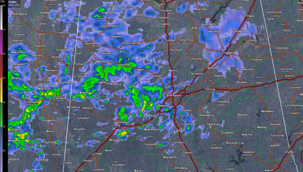
…Rain is moving in quicker this morning than we though. Decent rain now showing up on radar from Lamar and Fayette Counties down through Tuscaloosa and Bibb Counties. Means off and on rain into the afternoon for much of Central Alabama.
..Rain is massing along the Texas coast with weak low pressure that is trying to develop. This will be our cold rain tonight.
…Winds will increase late tonight with gusts over 20 mph after midnight. It will be breezy during the day and colder with gradual clearing.
…Rain moves in Monday earlier than previously expected. Rain likely by afternoon. Maybe we get another half inch.
…Could see a few showers Tuesday (rain or snow) in the cold advection pattern behind a big low that will spin up and move along the East Coast. Could be some big snow amounts in places up there.
…Significant freezes for us Wednesday and Thursday morning. Be ready to protect tender vegetation.
…Rain again comes earlier than thought Friday. Trended down with the rainfall amounts. Maybe one half inch. Low 60s for highs Friday will be our warmest day of the week.
…Flurries or showers possible Saturday again as cold air moves back in.



