


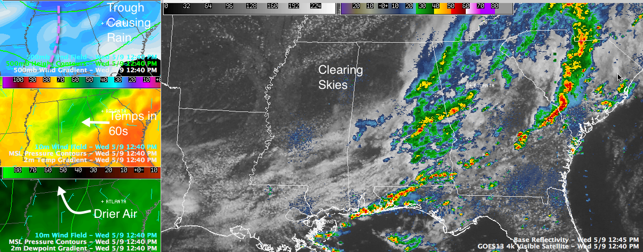
Click image to enlarge
Rain has pushed east of I-59 and I-65 this afternoon in Central Alabama. It is falling ahead of a trough of low pressure in the mid-levels of the atmosphere, up at about 18,000 feet. Drier air is filtering in behind the rain and skies clear quickly. It is already mostly sunny in places like Hamilton, Fayette and Parrish. Clouds are breaking up at Tuscaloosa. They will begin to break up shortly in Birmingham.
But rain is still falling across parts of Talladega, Clay, Calhon, Cleburne, Cherokee, Coosa, Elmore, Tallapoosa and Chambers Counties.
It is raining in places like Saks and Anniston. It is raining pretty heavily in Jacksonville and Piedmont. Rain is falling at Lineville.
It will begin raining in Fruithurst and Heflin soon. Talladega will experience a brief period of moderate rain shortly.
Places in Calhoun and Cleburne counties will see rain for over an hour. Other places will see shorter durations.
The rain is heaviest over parts of Elmore, Tallapoosa and Chambers counties, in towns like Camp Hill, Lafayette and Lanett. Rainfall rates are over 1/2 inch per hour in this area.
Rainfall amounts elsewhere are lighter.
0.71 inches in the 24 hours ending at 7 a.m. this morning at the Birmingham Airport. Another .11 since then.
Once the rain ends, it will be gone until at least the weekend.
Rain has kept temperatures cooler in the middle of the state, with readings hovering in the 60s. Tuscaloosa has already rebounded to 71F with a little sunshine. Places that see good sunshine this afternoon will make it well into the 70s. East Alabama locations might make it into the lower 70s at the last minute this afternoon if the sun comes out for a short while before sunset.
Tomorrow will be a wonderful weather day. We are contemplating a perfect weather watch for tomorrow, with sunshine, low humidities, a fresh north breeze and mild temperatures in the middle and upper 70s. That watch will likely be upgraded to a warning in the morning.



