


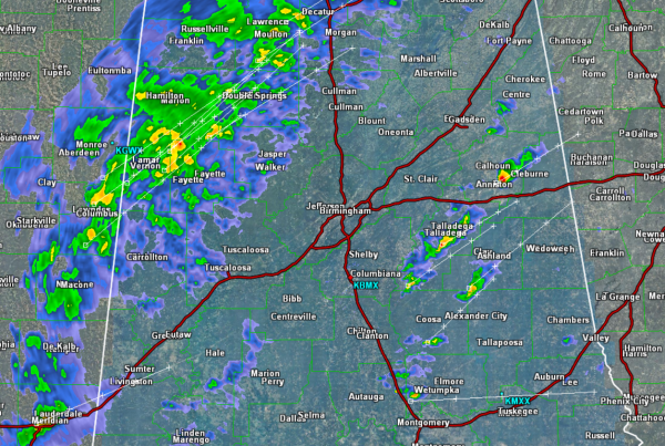
Showers and a few thunderstorms are affecting portions of Central Alabama late this afternoon.
The main area of rain is over northwestern Alabama and that stretches back into Central Mississippi. Moderate to heavy rain is falling with this rain mass and it will continuing shift east across the state the next few hours. All locations are expected to see a soaking rain as we head into the overnight hours. There is likely to be a few rumbles of thunder with some of the more intense downpours.
Heavy rain is currently falling across Lamar, Marion, Winston, and Fayette Counties.
We are seeing some thunderstorms develop out ahead of this main batch. These storms are east of Interstate 65 and are affecting portions of Calhoun, Talladega, Coosa, and Clay Counties. The individual storms are racing off to the northeast while the overall movement of the rest of the rain area is slowly towards the east.
We will be watching for a chance of some isolated areas of flooding that could develop in areas that are seeing persistent rainfall. Not expecting anything too widespread, just something to keep in mind heading out and about this evening.



