


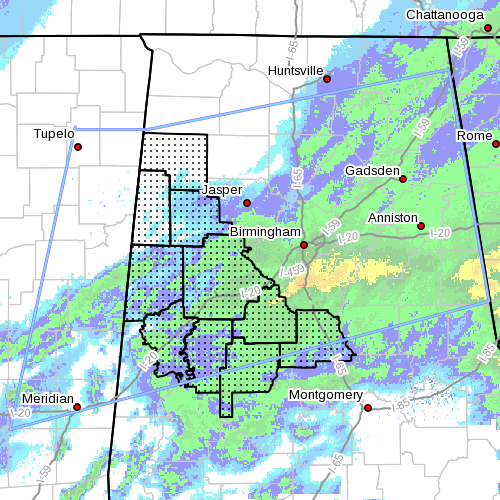
The NWS has canceled the Winter Weather Advisory for West Alabama…including Bibb, Chilton, Fayette, Greene, Hale, Lamar, Marion, Perry, Pickens and Tuscaloosa.
Snow is ending from the west across the northwestern counties and remains rain over the southern areas.
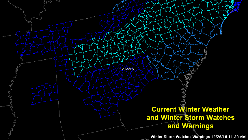
The Winter Weather Advisory continues for much of the rest of central Alabama. A Winter Storm Warning is in effect for several North Alabama counties.
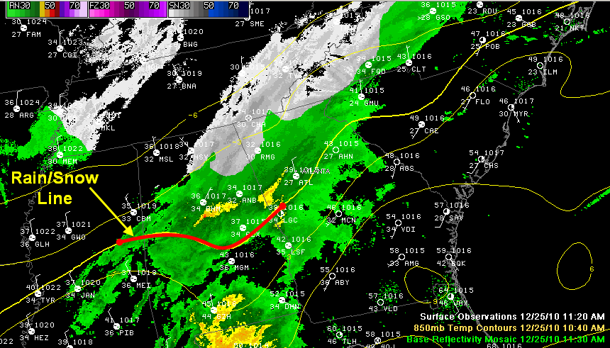
The rain/snow line continues pushing south and now extends from Eutaw to Mario to Maplesville to Dadeville to Lafayette. The heaviest snow right now is over parts of Jefferson, Shelby, St. Clair and Talladega Counties. Still snowing moderately here in Trussville and the strongest radar echoes are well south of us. It is snowing to beat the band right now in places like Maylene, Alabaster, Harpersville and Vincent. This activity is pushing east.
Snow will taper off from west to east across the area, but more snow showers will occur tonight and Sunday morning as colder air aloft pushes into the state from the northwest. This activity is not expected to cause as much accumulation as the first round, but with temperatures dropping into the upper 20s, roads will be more prone to icy spots.
Areas that have snow covered roads will be slippery, especially on bridges and overpasses. There have been numerous accidents over parts of North Alabama this morning.
In North Alabama, officials in towns of Geraldine, Ider and Henegar have shut down their city streets. Travel at own risk in these areas.
Some snow reports…
…4 inches in Peeks Corner on Lookout Mountain
…3.5 inches west of Moulton
…3 inches in Limestone County near French Mill
…2.5 inches near Fyffe in DeKalb County
…2.5 inches near New Market in madison County
…2.5 inches at West Point in Cullman County
…2.3 inches at Hampton Cove south of Huntsville
…2 inches at Meridianville
…1.5 inches at Oxford according to Daniel
…1 inch near Holly Pond
…



