


Here is a quick look at the three banner weather events for Alabama over the next week…
RAIN CONTINUES: Today will be a cool, wet day for Alabama with periods of rain. A warm front is over South Alabama, and will move only slowly northward today; the northern counties will stay in a cool airmass with temperatures struggling to get out of the 40s.
We should mention strong storms are possible today over far South Alabama, south of the warm front, where the air is unstable. SPC has a “marginal” risk of severe storms defined there…
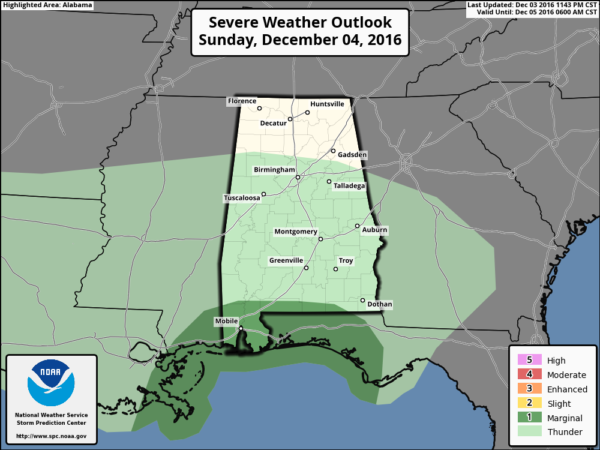
Rain continues at times into the day tomorrow as the unsettled pattern continues.
UNSTABLE AIR ADVANCES NORTHWARD: As the warm front lifts northward in response to low pressure developing just west of Alabama, strong storms will be possible deeper into our state tomorrow night into Tuesday morning. We have the standard “slight risk” of severe weather defined for areas south of a line from Grove Hill to Dothan, with a “marginal risk” up to Moundville, Verbena, and Auburn.
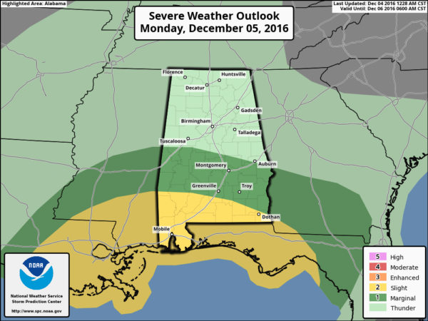
For the moment it looks like the risk of severe weather for the northern half of the state tomorrow night is rather low, but but zero. All a matter of how far north the “warm sector” moves. The main window for the stronger storms over the southern counties will come from about 10:00 tomorrow night through 10:00 Tuesday morning. A few storms over South Alabama could produce damaging winds, hail, and a few tornadoes.
RAIN AMOUNTS: Storm totals (counting the rain that came down yesterday) will be in the 3-4″ range for most of Alabama by Tuesday, when the rain will end from west to east. This won’t end the drought, but we are moving in the right direction. Birmingham’s rain deficit for the year is 11.71″ as of late last night.
ARCTIC BLAST: The coldest air so far this season invades the state late this week; by Friday the Tennessee Valley of far North Alabama could stay below freezing all day, with highs only in the mid 30s for places like Birmingham, Tuscaloosa, Anniston, and Gadsden…
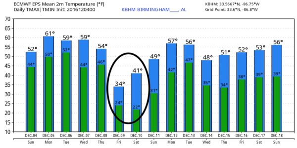
There could be a few sprinkles or flurries as the cold air rushes in Thursday, but nothing significant with a very dry airmass in place.
No sign of any winter weather woes (snow, ice, etc) for Alabama for the next 10 days…



