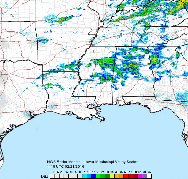
Showers were showing up on radar this morning especially along and north of the Interstate 20 corridor. The sounding from the Shelby County Airport last night continued to show a dry layer between about 4,000 and 12,000 feet, so very little of that precipitation is actually reaching the ground. That will change, naturally, through the morning and into the early afternoon as that layer slowly moistens, so expect to see showers become more numerous this afternoon with stations beginning to report measurable precipitation. It will remain mild with highs climbing into the 60s for North and Central Alabama.
The upper air pattern will remain nearly zonal with a slight southwesterly component to it so that moisture will continue to stream from the Pacific across Mexico and into and across the southern US. The total rain expected for Central Alabama will likely be in the 1.75″ to 2.50″ range. Hopefully, with this rain coming over the next four days, we may be able to avoid any flooding or flash flooding issues since the last week or so has been dry. Flash flooding could become an issue for us from Tuesday afternoon into Wednesday when strong to severe storms will be possible.
The upper flow will gradually become more southwesterly as an upper level trough and closed low come out of the Rockies into North Texas Tuesday. At the surface, a stationary front will become situated across Central Alabama for the next several days, so with a steady parade of upper level short wave impulses we’ll be seeing rain off and off through Tuesday. Temperatures will remain mild with lows in the 50s and highs in the 60s through Tuesday.
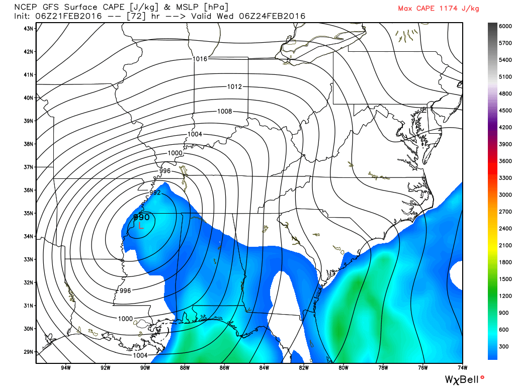
Tuesday and Wednesday we will see big changes. That upper level closed low will come across the Mississippi River late Tuesday into Wednesday setting the stage for strong to severe storms for the Southeast US including Alabama. Agreement between the GFS and European, which has been all over the map, has gotten better on this run with the position and timing of the surface low and the front much closer than we’ve been seeing. They are still not identical, so there remains some uncertainty in the exact timing for severe weather. The surface low moves from northern Louisiana on Tuesday evening to near Cincinnati on Wednesday evening according to the GFS. This places the greatest instability and shear over Central and North Alabama between 3 pm Tuesday and 10 am on Wednesday. SPC has not identified a specific severe weather risk area yet since this is still in the Day 3/Day 4 time frame and there remain some model differences.
Since this appears likely to be an overnight severe weather threat for Central Alabama, it is really important that everyone check to be sure you can receive weather warnings during this period. Having more than one method for receiving warnings is a good idea.
Based on the current model positioning of the front, Wednesday is likely to be one of those days where the temperature falls much of the day with the morning daybreak temperature the high for the day and the low for the day occurring close to midnight on Wednesday.
After the trough moves to the East Coast Thursday, we will have another forecast issue to deal with and that is the potential for some wrap around snow showers. Temperatures Thursday morning will be close to the freezing mark, so we could see some flurries or even some light snow in snow showers. But as we’ve told you before, this pattern with wrap around moisture does not typically produce significant snow events for us.
The surface low moves into the eastern Great Lakes on Thursday producing stormy conditions for the Northeast US along with some additional winter weather on Thursday. But for us, the upper flow quickly becomes less amplified Thursday into Friday, so while we’ll see some chilly morning lows, afternoon highs should be in the 50s for the end of the week and the start of the weekend.
By Sunday, the flow has become nearly zonal once again and a weak impulse coming out the Central Rockies will generate a surface low in the vicinity of the Texas Panhandle with the main threat for rain staying west of the Mississippi River.
Looking into voodoo country, the GFS remains active with a fairly strong short wave trough producing another round of wet weather in the March 1/March 2 time frame. And that trough is followed by another one around March 6th. The good news is that the upper flow does not show any signs of anything especially cold for the southern US.
It was nice filling in for Meaghan Thomas last night on ABC 3340 while she did an appearance for the Ronald McDonald charity event. I expect James Spann to be back in the saddle once again on Monday morning with the next edition of the Weather Xtreme Video including the latest on the severe weather potential for Tuesday/Wednesday. Enjoy your Sunday and stay dry. Godspeed.
-Brian-
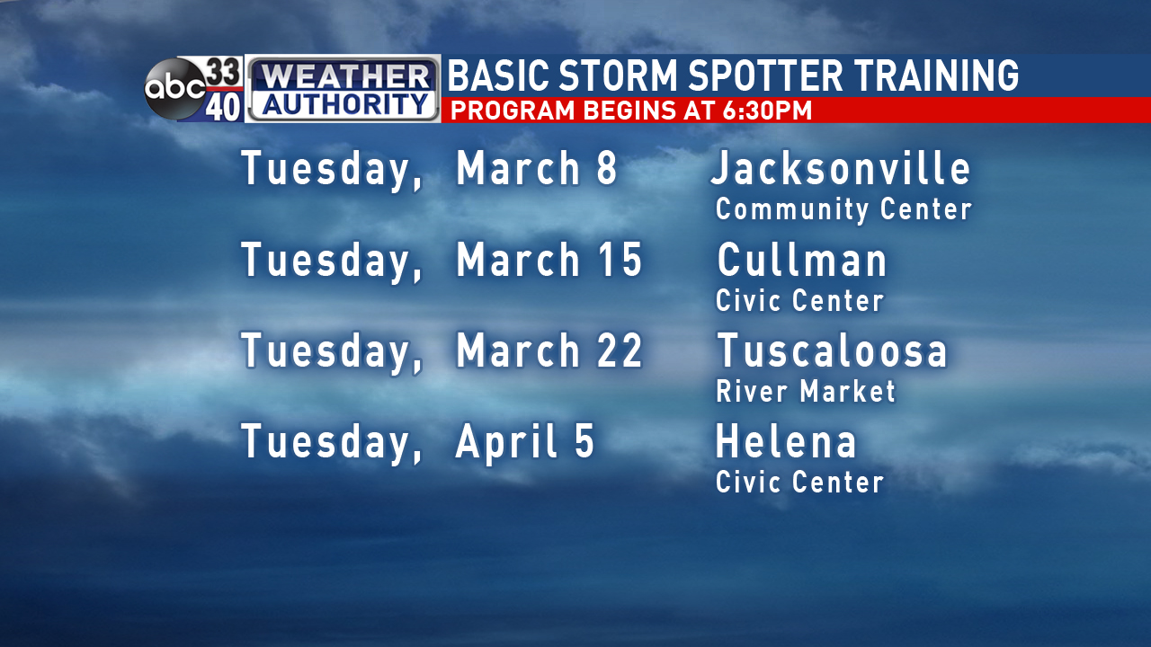
PS Don’t forget our spotter training plans for March and early April.