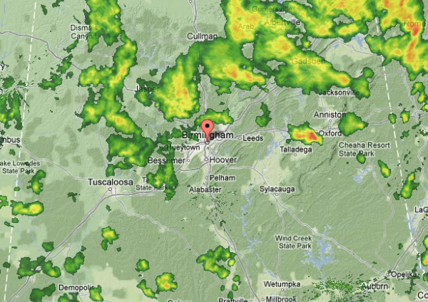
Scattered showers and thunderstorms continue across the Alabama landscape this afternoon. A cold rain is falling in many locations that are being affected from this convective activity. The strongest storm in the state is affecting of all places Talladega, where it is causing a red flag at the track. The storm is producing hail, heavy rain and has been producing lightning.
Heavy rain showers are also affecting areas in Walker and Blount Counties. Rain is falling and event some small hail is mixing in with it in many areas. Very cold air aloft is making it down to the surface today, making it a down right miserable day across the northern half of the state. Upper-level low will continue to spin across the state and allow for this unseasonably cool and unsettled weather to persist into the overnight hours.