


SUN, HEAT, STORMS: No real change in Alabama’s weather situation through tomorrow. Afternoon highs mostly in the low to mid 90s, with random, scattered showers and thunderstorms around during the afternoon and evening hours. SPC has the northern half of the state in a “marginal risk” (level 1/5) of severe thunderstorms; like recent days the storms will be very healthy where they form. The main threat will come from strong winds and frequent lightning.
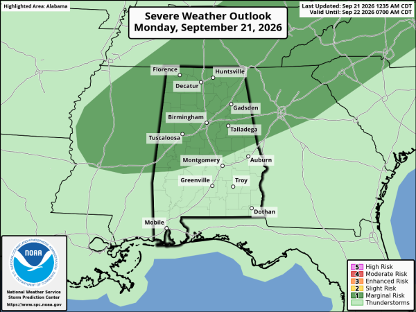
Best chance of scattered storms will come from around 2:00 until 9:00 p.m.
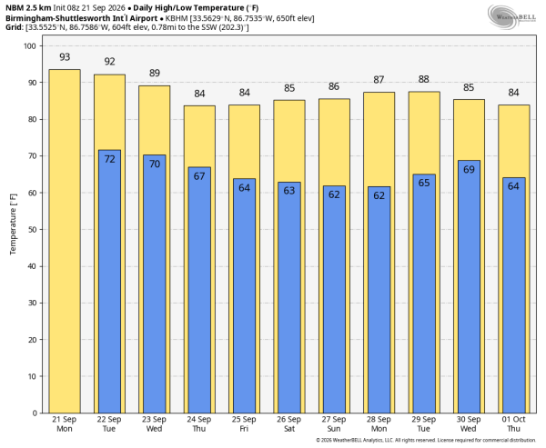
COOLER DAYS: We finally get a shot of cooler air later this week. Highs drop into the mid 80s by Thursday and Friday, with morning lows in the low to mid 60s. About ten degrees lower than what we have experienced for much of September. The air will be drier and most places will be rain-free.
The weekend at this point looks dry with highs in the 80s and lows in the 60s, but cooler spots across North Alabama will dip into the mid to upper 50s Saturday and Sunday morning.
No sign of any major, widespread rain event for the Deep South for the next 7-10 days; best hope is that you catch one of the scattered afternoon storms today or tomorrow… See the video briefing for maps, graphics, and more details.
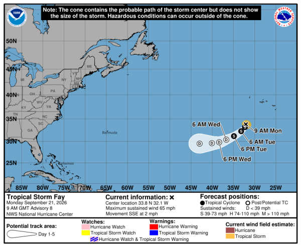
TROPICS: Tropical Storm Fay, with 65 mph winds, is in the Atlantic about 400 miles southwest of the Azores far from land. It will weaken today, and is expected to dissipate by tomorrow night. The rest of the Atlantic basin remains very quiet.
ON THIS DATE IN 1989: Hurricane Hugo made landfall on Isle of Palms, South Carolina as a Category 4 hurricane around midnight (technically landfall was just after midnight on September 22, 1989). Hugo produced tremendous wind and storm surge damage along the coast and even produced hurricane force wind gusts several hundred miles inland into western North Carolina. In fact, Hugo produced the highest storm tide heights ever recorded along the U.S. East Coast, around 20 feet in Bulls Bay, SC near Cape Romain. Charleston County was at the epicenter of Hugo’s devastation. At McClellanville, near the point of maximum storm surge, shrimp boats were pushed as far as 1/2 mile inland. Commercial and recreational craft damaged other structures as they were carried ashore.
There were at least 39 fatalities during the post-storm recovery phase; more people died in South Carolina in the hurricane’s aftermath than during its passage. Among the indirect fatalities were two people killed by house fires started by candles during the storm.
Look for the next video briefing here by 3:00 this afternoon… enjoy the day!



