UNSETTLED SUMMER WEATHER: A moist, unstable airmass will cover Alabama through the weekend, and we will deal with scattered to numerous showers and thunderstorms on a daily basis. Most of them will come from about noon to midnight, but we can’t rule out a few late night or morning showers in this pattern. And, where storms form, they could be pretty strong. SPC has all 67 Alabama counties in a “marginal risk” (level 1/5) today and tomorrow…
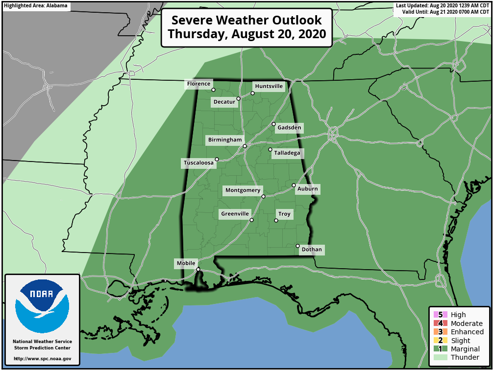
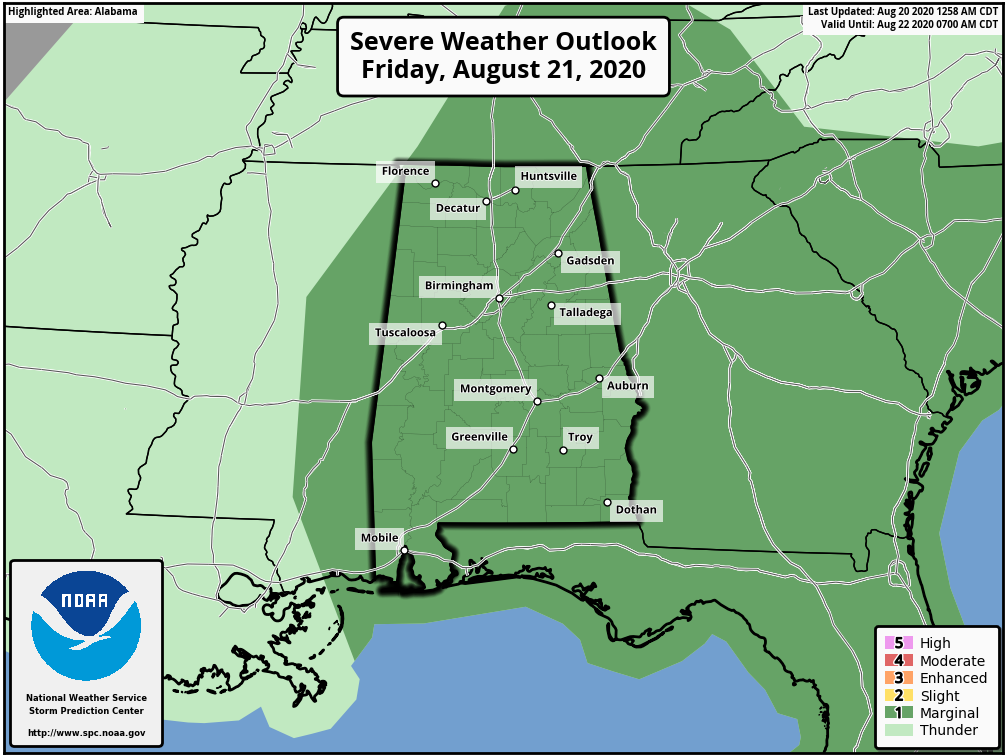
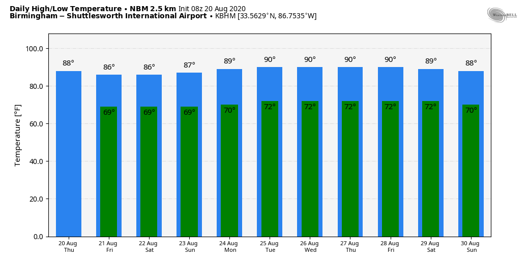
The main threat will come from strong straight line winds and small hail. Storms will also be capable of producing very heavy amounts of rain; radar estimated about three and a half inches of rain yesterday near Addison in Winston County. Flooding was also an issue around Wetumpka last night. Highs will be mostly in the mid to upper 80s each day through Sunday with only a limited amount of sun.
NEXT WEEK: The weather next week will all depend on how the tropical systems behave. It is simply too early to know the impact on Alabama, so for now we will keep a summer persistence forecast going; partly sunny days with scattered showers or thunderstorms. But just know the forecast could change a good bit in doing days. See the Weather Xtreme video for maps, graphics, and more details.
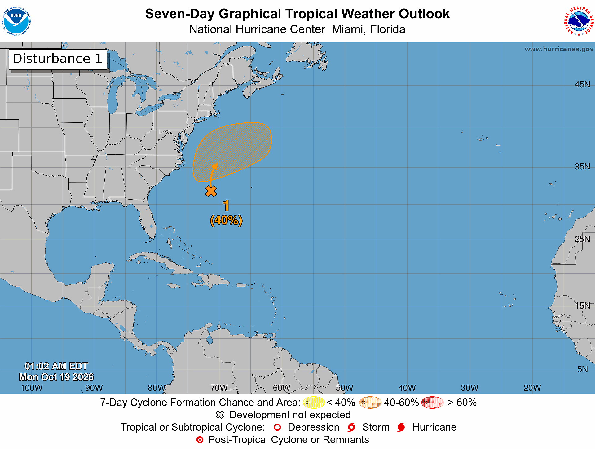
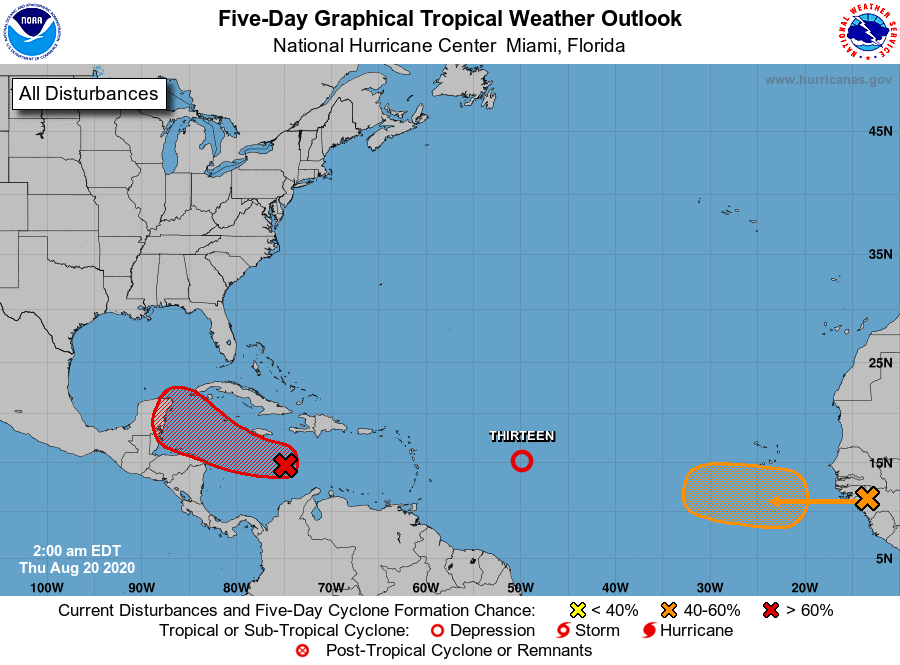
TROPICS: We continue to monitor three areas of interest across the Atlantic basin… a wave that will come off the coast of Africa today, newly formed Tropical Depression 13 in the central Atlantic, and Invest 97L, a tropical wave in the Caribbean.
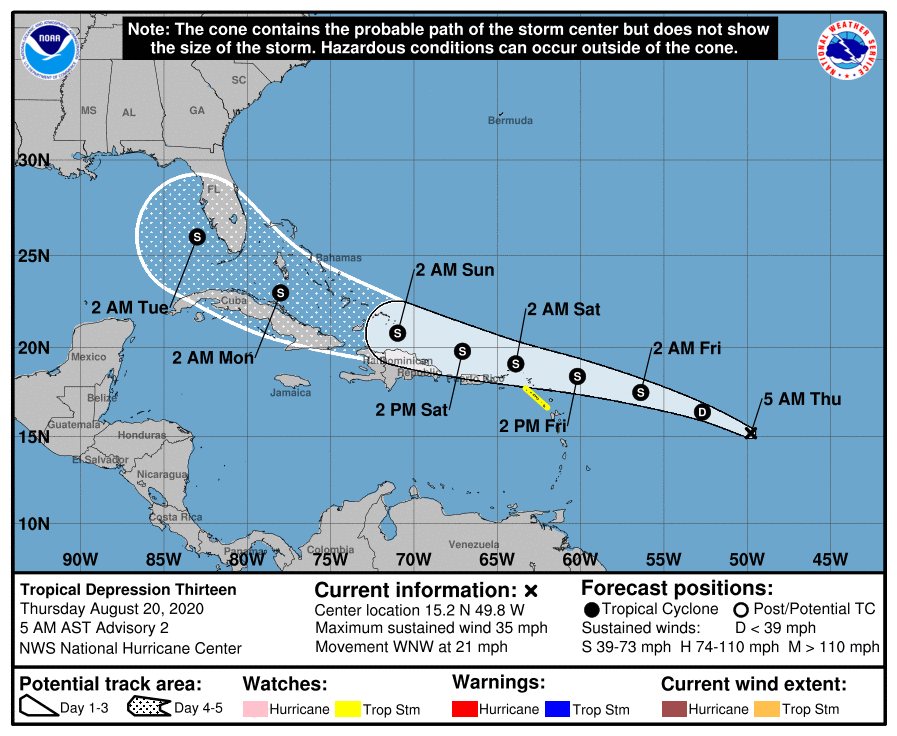
TD 13: The new tropical depression in the central Atlantic is expected to become Tropical Storm Laura within the next 24 hours. The NHC forecast has it on a track that will take it just north of Puerto Rico and Hispaniola, winding up in the Southeast Gulf of Mexico early next week. The American global model, the GFS, keeps the system weak due to potential dry air entrainment, which is a possibility as satellite imagery suggests Saharan dust not far from the cyclone. Between this and the possibility of land interaction, the low-confidence intensity forecast from NHC is changed little from the previous advisory. We should note a few models show the system actually ramping up to a major hurricane.
It remains to be seen what, if any impact this system will have on Alabama or the Central Gulf Coast. If there is an impact, it will be around Wednesday or Thursday of next week.
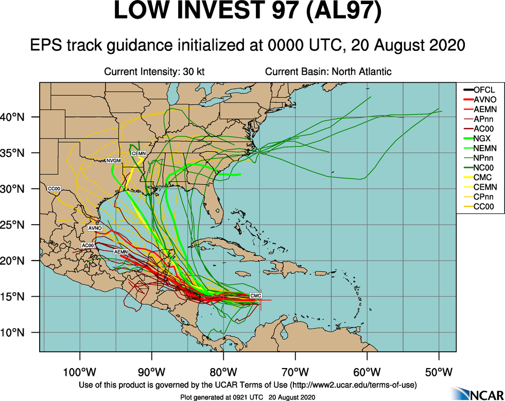
INVEST 97L: This tropical wave and accompanying broad area of low pressure is producing an area of showers and thunderstorms over the central Caribbean Sea. This system is gradually becoming better organized, and a tropical depression is likely to form in a couple of days when the system reaches the northwestern Caribbean Sea. This system is moving westward, and interests in Honduras and the Yucatan Peninsula should closely monitor its progress. Regardless of development, this disturbance will likely produce heavy rains across a large portion of Central America and southeastern Mexico late this week and this weekend.
The system will likely wind up in the Southwest Gulf of Mexico late in the weekend; and once again, we simply don’t know if there will be impact on our region. It could wind up anywhere from Mexico to the Florida Panhandle. There will be much better clarity by the weekend.
And, finally, a tropical wave over western Africa is producing disorganized showers and thunderstorms. This wave is expected to move over the far eastern tropical Atlantic on Friday, and some slow development is possible through the weekend while it moves west-northwestward at 15 to 20 mph across the eastern tropical Atlantic. This is far from the U.S… just something to watch for now.
The Gulf of Mexico will remain quiet through the weekend.
We should mention for those on the Gulf Coast, you should always be prepared for a hurricane every year during the months of August and September… this is the peak of the hurricane season.
ON THIS DATE IN 2011: A tropical wave was upgraded to Tropical Storm Irene east of the Leeward Islands. It would go on to make landfall on the Outer Banks of North Carolina on August 27, becoming the first hurricane to make landfall in the United States since Hurricane Ike in 2008.
BEACH FORECAST: Click here to see the AlabamaWx Beach Forecast Center page.
WEATHER BRAINS: Don’t forget you can listen to our weekly 90 minute show anytime on your favorite podcast app. This is the show all about weather featuring many familiar voices, including our meteorologists here at ABC 33/40.
CONNECT: You can find me on all of the major social networks…
Facebook
Twitter
Instagram
Pinterest
Snapchat: spannwx
Look for the next Weather Xtreme video here by 4:00 this afternoon… enjoy the day!