


The storm just north of the one we have been talking about in Coosa County is intensifying and the NWS has issued a severe thunderstorm warning.
It includes Clay, Coosa and Tallapoosa Counties. It goes until 330 p.m.
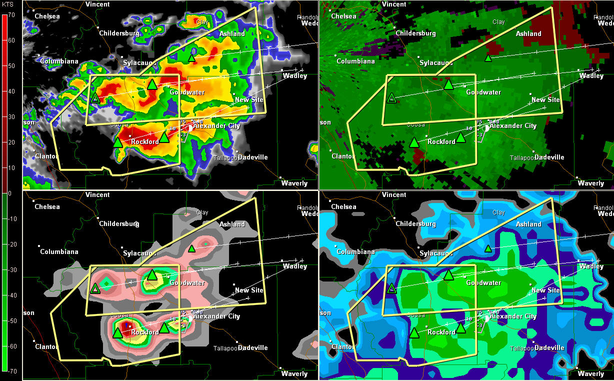
Here is a four panel radar display. You can see two rotations in the upper right panel, one near Rockford and one just east of Goodwater.
Lots of heavy rain on the upper left panel all over eastern Coosa, southern Clay and Tallapoosa Counties.
The lower left panel shows three hail cores including the Rockford, Goodwater storms and one approaching Alexander City.
These are the only warnings in effect for Alabama right now. A tornado watch remains in effect until 8 p.m. CDT.
An incredible boundary exists this afternoon from roughly north of Columbus MS to north of Tuscaloosa to around Clanton to Alex City. Very warm, moist air is present south of the boundary with cooler, relatively drier air to the north. This extreme boundary will provide the focus for additional severe storms to develop through teh afternoon and into this evening across Alabama.
Folks from Alex City to Jackson’s Gap up to New Site and Ashland should be safe shelter as these dangerous storms approach. They have a history of producing tennis ball sized hail. They could also produce a tornado at any time.



