


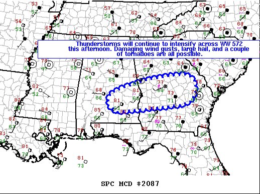
Here is the text of the latest Mesoscale Discussion from the SPC:
The severe weather threat for the Severe Thunderstorm Watch continues.
SUMMARY… Thunderstorms will continue to intensify across the watch this afternoon. Damaging wind gusts, large hail, and a couple of tornadoes are possible.
DISCUSSION… A band of semi-discrete supercell clusters will continue spreading generally eastward across parts of east-central AL and central GA over the next several hours. Within the pre-convective environment, moist south-southwesterly trajectories (upper 60s/lower 70s dewpoints) off the eastern Gulf of Mexico combined with diurnally steepening low-level lapse rates are resulting in favorable surface-based inflow. Generally weak forcing for ascent across the area combined with deep-layer shear vectors oriented obliquely to the low-level axis of forcing should support the maintenance of separated updrafts. Ahead of the ongoing convection, the latest RAP mesoanalysis and VWPs show effective SRH values of 150-180 m2/s2 and 0-6 km bulk shear of 50-60 knots. These factors will continue to support the risk of semi-discrete supercell structures capable of producing large hail, damaging wind gusts, and a couple of tornadoes. The tornado risk may eventually become maximized over portions of south-central GA, where surface winds should remain slightly more backed beneath a strengthening 850-mb low-level jet.



