


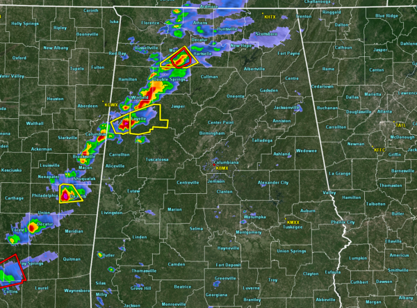
Strong to severe storms continue to march across the northwest portions of North/Central Alabama as we are approaching the 3:00 pm hour on this Thursday afternoon. We currently have a tornado warning in effect for Lawrence County until 3:15 pm for a rotating cell located just to the south of Wren and is moving to the northeast at 40 MPH.
Another strong cell that needs watching is the severe thunderstorm-warned cell that is affecting Lamar and Fayette counties. Large hail and gusty winds are possibly with this cell. People in Fayette, Berry, and Newtonville need to be ready just in case rotation tightens up and a tornado warning is issued.
Helicity has relaxed some over northwestern parts of the area, with latest reading showing around 350m2/s2. Instability continues to climb to well over 1,500 J/kg over parts of the area just ahead of the storms.
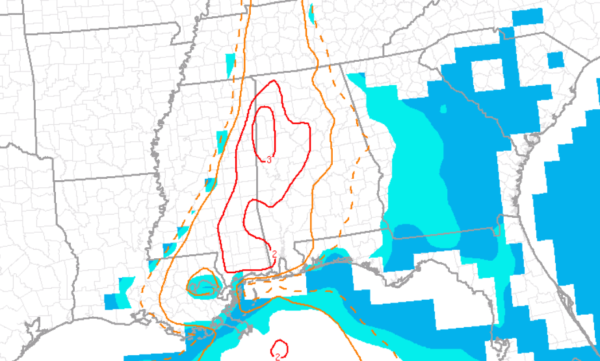
STP values continue to be in the 2.0-3.0 range over the west and northwestern parts of the area.
Conditions continue to be ripe for severe thunderstorms and should be that way through at least the next several hours.
We have reports of trees down in Colbert and Lamar counties, but unknown if they were from severe thunderstorm winds or gradient winds at this point.
We’ll continue to keep you posted on the blog.



