


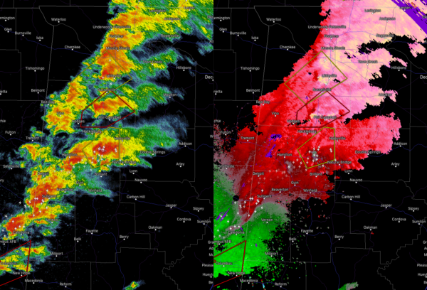
We continue to have strong to severe storms pushing northeastward across the northwestern parts of the area. Some of these cells have circulation present, some of which a little stronger than others.
The most worrisome cell continues to be over the eastern parts of Marion County where rotation is heading towards Haleyville. It was showing some sign of something going on in the CC part of radar causing a spike out from the Columbus radar site past the cell.
Other cells that have warnings on them are a Tornado Warning for Franklin County and a Severe Thunderstorm Warning for Colbert and Franklin counties.
So far, no reports of damage have come into the chat. Plenty of pictures of wall clouds coming in from the Spann Twitter Army.
We’ll continue to keep you posted.



