


RADAR CHECK: We started off this day with a batch of rain and storms this morning over Northwest Alabama… but this afternoon the action has shifted over to the eastern counties of the state on the outflow of the morning storms. Most of the rain at mid-afternoon was east of a line from Anniston to Selma; some places there are seeing heavy amounts of rain.
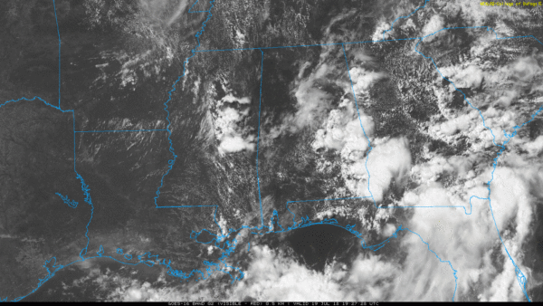
Showers and storms will settle down later tonight.
SEVERE WEATHER THREAT: Tomorrow will be hot, and a decent part of the day looks dry with a high in the low 90s. A few storms, of course, are always possible during the peak of the heat, but high resolution models suggest they will be few and far between. This will allow temperatures to rise into the low 90s, and with a rather deep upper trough for July, instability values will rise greatly across the state by evening.
We still expect an organized batch of storms to roll through North/Central Alabama tomorrow night into the pre-dawn hours Saturday. SPC has expanded the severe weather threat on their outlook for tomorrow night; we now have an “enhanced risk” (level 3/5) across the Tennessee Valley of far North Alabama, and the standard “slight risk” (level 2/5) down to Tuscaloosa, Birmingham, and Anniston. A “marginal risk” (level 1/5) is defined as far south as Thomasville, Greenville, and Opelika.

Here is the current thinking:
*The main window for severe storms will come from 9:00 p.m. tomorrow through 6:00 a.m. Saturday.
*Main threat will come from damaging straight line winds, but an isolated tornado is certainly possible based on the projected wind fields.
*Be sure and pay attention to warnings, including severe thunderstorm warnings tomorrow night.
*Forecasting these northwest flow thunderstorm events can be challenging, so look for forecast changes over the next 24 hours.
REST OF THE WEEKEND: Storms will wind down Saturday morning, and a decent part of the midday and afternoon hours should be dry, although a few isolated showers or storms will be possible. The high Saturday will be close to 90. Then, on Sunday, we are forecasting a mix of sun and clouds with scattered showers and storms… the high will be in the mid to upper 80s.
NEXT WEEK: Temperatures should be below average through the week with highs in the 80s; we will have scattered showers and thunderstorms around on a daily basis with some sun at times. See the Weather Xtreme video for maps, graphics, and more details.

TROPICS: Tropical storm formation is not expected across the Atlantic basin, including the Gulf of Mexico, for the next 5-7 days.
BEACH FORECAST: Click here to see the AlabamaWx Beach Forecast Center page.
WEATHER BRAINS: Don’t forget you can listen to our weekly 90 minute netcast anytime on the web, or on iTunes. This is the show all about weather featuring many familiar voices, including our meteorologists here at ABC 33/40.
CONNECT: You can find me on all of the major social networks…
Facebook
Twitter
Google Plus
Instagram
Pinterest
Snapchat: spannwx
I had a great time today visiting with the kids in the summer program this morning at Hubbertville School in Fayette County… be looking for them on the Pepsi KIDCAM today at 5:00 on ABC 33/40 News! The next Weather Xtreme video will be posted here by 7:00 a.m. tomorrow.



