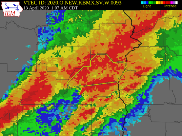
The National Weather Service in Birmingham has issued a
* Severe Thunderstorm Warning for…
Southeastern Bullock County in southeastern Alabama…
Barbour County in southeastern Alabama…
* Until 200 AM CDT.
* At 1243 AM CDT, severe thunderstorms were located along a line
extending from near Guerryton to near Banks, moving east at 50 mph.
HAZARD…60 mph wind gusts.
SOURCE…Radar indicated.
IMPACT…Expect damage to roofs, siding, and trees.
* Locations impacted include…
Eufaula, Midway, Clayton, Pickett, Hawkinsville, Spring Hill,
Gaino, Comer, Barbour County Public Lake Dam, Osco, White Oak,
Lakepoint Resort State Park, Boot Hill, Tanyard, Batesville,
Clayton Municipal Airport, Perote, Twin Springs, Lugo and Three
Notch.
PRECAUTIONARY/PREPAREDNESS ACTIONS…
A Tornado Watch remains in effect until 600 AM CDT for southeastern
Alabama.
For your protection move to an interior room on the lowest floor of a
building.