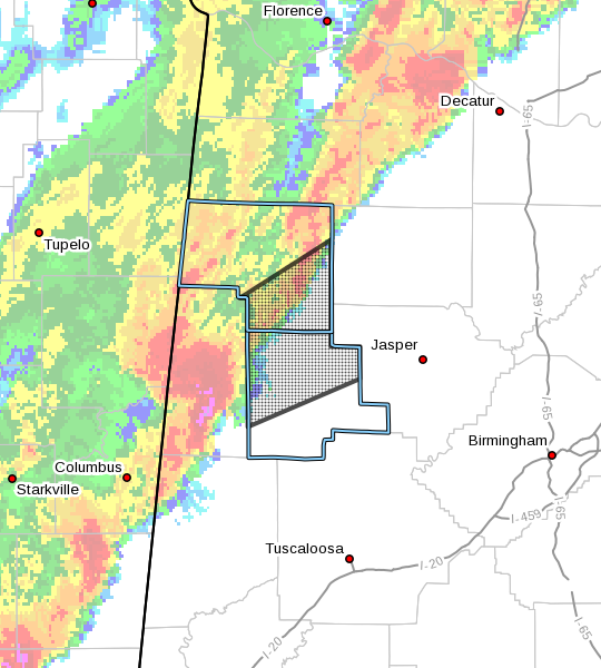
The National Weather Service in Birmingham has issued a
* Severe Thunderstorm Warning for…
Southeastern Marion County in northwestern Alabama…
Northern Fayette County in west central Alabama…
* Until 300 AM CDT.
* At 208 AM CDT, severe thunderstorms were located along a line
extending from near Lamar County Airport to near Vernon to near
Millport, moving northeast at 75 mph.
These are very dangerous storms.
HAZARD…Baseball size hail and 70 mph wind gusts.
SOURCE…Radar indicated.
IMPACT…People and animals outdoors will be severely injured.
Expect shattered windows, extensive damage to roofs,
siding, and vehicles.
* Locations impacted include…
Winfield, Fayette, Guin, Brilliant, Glen Allen, Belk, Gu-
Win, Lake Buttahatchee, Bluff, Twin, Tucker, Bazemore, Wayside,
Richard Arthur Field, Bevill State College Fayette, Hubbertville,
Fowlers Crossroads, Texas and Piney Grove.
PRECAUTIONARY/PREPAREDNESS ACTIONS…
A Tornado Watch remains in effect until 500 AM CDT for central,
northwestern and west central Alabama.
For your protection move to an interior room on the lowest floor of a
building.