


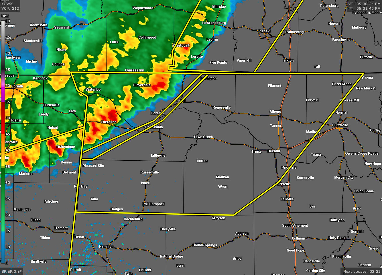
The National Weather Service in Huntsville Alabama has issued a
* Severe Thunderstorm Warning for…
Northwestern Madison County in north central Alabama…
Eastern Lauderdale County in northwestern Alabama…
Limestone County in north central Alabama…
Colbert County in northwestern Alabama…
Franklin County in northwestern Alabama…
Northwestern Morgan County in north central Alabama…
Lawrence County in northwestern Alabama…
* Until 630 PM CDT.
* At 529 PM CDT, severe thunderstorms were located along a line
extending from near Loretto to near Underwood-Petersville to 7
miles east of Tishomingo State Park to near Sandy Springs, moving
southeast at 45 mph.
HAZARD…60 mph wind gusts and nickel size hail.
SOURCE…Radar indicated.
IMPACT…Expect damage to roofs, siding, and trees.
* Locations impacted include…
Northwestern Huntsville, Decatur, Madison, Florence, Athens,
Hartselle, Muscle Shoals, Russellville, Sheffield and Tuscumbia.
PRECAUTIONARY/PREPAREDNESS ACTIONS…
For your protection move to an interior room on the lowest floor of a
building.
This is a DANGEROUS SITUATION. These storms are producing widespread
wind damage across Lauderdale and Colbert Counties. SEEK SHELTER NOW
inside a sturdy structure and stay away from windows!
If on or near The Tennessee River, get away from the water and move
indoors or inside a vehicle. Remember, lightning can strike out to
15 miles from the parent thunderstorm. If you can hear thunder, you
are close enough to be struck by lightning. Move to safe shelter
now! Do not be caught on the water in a thunderstorm.



