


BULLETIN – IMMEDIATE BROADCAST REQUESTED
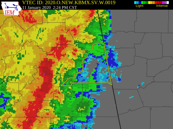
Severe Thunderstorm Warning
National Weather Service Birmingham AL
223 PM CST Sat Jan 11 2020
The National Weather Service in Birmingham has issued a
* Severe Thunderstorm Warning for…
Cleburne County in east central Alabama…
* Until 345 PM CST.
* At 223 PM CST, severe thunderstorms were located along a line
extending from near Alexandria to 7 miles east of Sycamore, moving
northeast at 50 mph.
HAZARD…70 mph wind gusts.
SOURCE…Radar indicated.
IMPACT…Expect considerable tree damage. Damage is likely to
mobile homes, roofs, and outbuildings.
* Locations impacted include…
Heflin, Ranburne, Fruithurst, Edwardsville, Muscadine, Abernathy,
Mars Hills, Mount Cheaha, Hollis Crossroads, Sweetwater Lake,
Coleman Lake And Campground, Trickem, Lake Cleburne, I 20 Welcome
Center, Liberty Hill, Chalafinnee, Oak Level, Borden Springs and
Camp Sequoyah.
PRECAUTIONARY/PREPAREDNESS ACTIONS…
A Tornado Watch remains in effect until 800 PM CST for northeastern
and east central Alabama.
For your protection move to an interior room on the lowest floor of a
building.



