


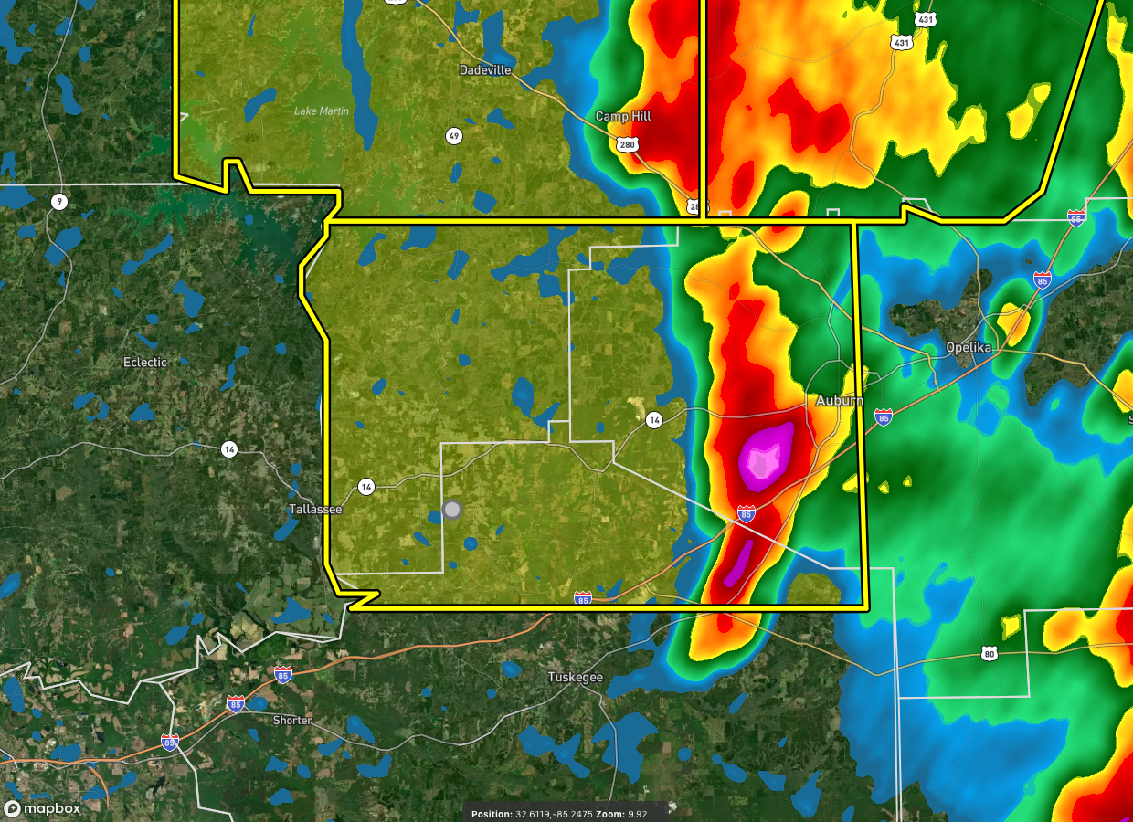
The National Weather Service in Birmingham has issued a
* Severe Thunderstorm Warning for…
Northwestern Lee County in east central Alabama…
Northeastern Macon County in southeastern Alabama…
Southeastern Tallapoosa County in east central Alabama…
* Until 845 PM CDT.
* At 802 PM CDT, a severe thunderstorm was located near Tuskegee
National Forest, or near Auburn, moving west at 20 mph.
HAZARD…60 mph wind gusts and quarter size hail.
SOURCE…Radar indicated.
IMPACT…Hail damage to vehicles is expected. Expect wind damage
to roofs, siding, and trees.
* Locations impacted include…
Auburn, Tuskegee, Tallassee, Notasulga, Franklin, Waverly, Martin
Dam, Liberty City, Reeves Airport, Auburn University, Tallapoosa
City, Tuskegee National Forest, Southern Lake Martin, Loachapoka,
Yates Dam, I 85 Rest Area, Uphapee Creek, Chewacla State Park,
Roxana and Reeltown.
PRECAUTIONARY/PREPAREDNESS ACTIONS…
For your protection move to an interior room on the lowest floor of a
building.



