


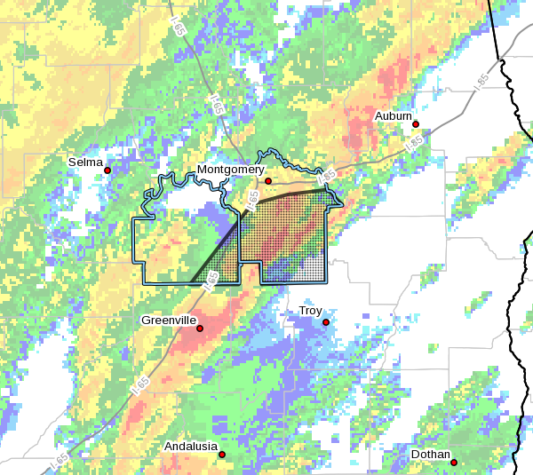
The National Weather Service in Birmingham has issued a
* Severe Thunderstorm Warning for…
Southeastern Lowndes County in south central Alabama…
Montgomery County in south central Alabama…
* Until 1030 AM CST.
* At 927 AM CST, a severe thunderstorm was located near Greenville,
moving northeast at 55 mph.
HAZARD…60 mph wind gusts.
SOURCE…Radar indicated.
IMPACT…Expect damage to roofs, siding, and trees.
* Locations impacted include…
Southeastern Montgomery, Fort Deposit, Meadville, Pike Road, Pine
Level, Hyundai Motors Of Alabama, Dublin, Snowdoun, Grady, Sellers,
Davenport, Ramer, Pintlala, Lowndes County Airport, Strata, Naftel,
Hope Hull, Logan, Sprague and Pinedale.
PRECAUTIONARY/PREPAREDNESS ACTIONS…
A Tornado Watch remains in effect until noon CST for south central
and southeastern Alabama.
For your protection move to an interior room on the lowest floor of a
building.



