


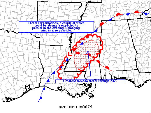
From the latest SPC Mesoscale Discussion…
The severe weather threat for Tornado Watch 22 (parts of Louisiana and Mississippi) continues.
SUMMARY
The threat for tornadoes has undergone a significant increase during the past hour from the southwest through central MS, and this threat is expected to persist into the evening including the potential for a couple of strong tornadoes.
DISCUSSION
Storms have undergone a significant increase in organization during the past hour. A couple of storms with a history of producing tornadoes persist from southwest through central MS. Activity is increasing east and southeast of a surface low that will deepen and track northeast along a stationary front this evening. Large low-level hodographs with 300-400 m2/s2 0-1 km storm-relative helicity exist along a strengthening low-level jet and within a moderately unstable environment. Additional storms developing in the warm sector will likely organize as supercells and bowing segments with an attendant threat for tornadoes and damaging wind.



