


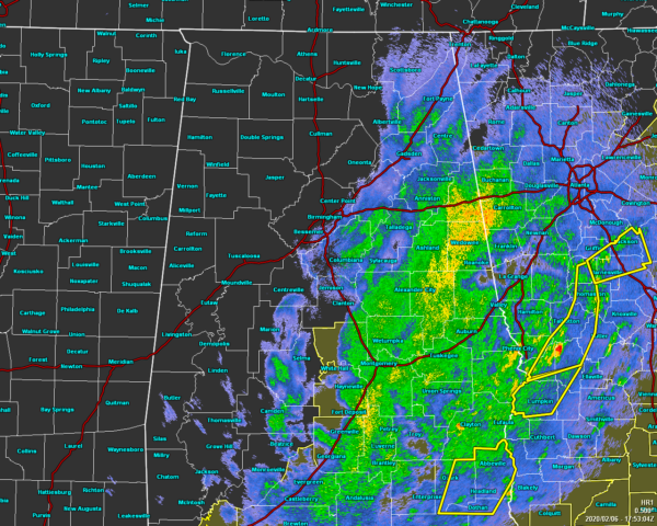
You can just about wrap up this severe weather event for Central Alabama as the threat will be ending as we make it to the midday hour and remaining counties in the Tornado Watch will be allowed to expire.
Nearly all of the rainfall is along and east of the I-65 corridor with a few light to moderate showers just west of that near Selma. Much of the western half of the area is dry with cloudy skies.
A Flash Flood Watch remains in effect until 6:00 pm tonight for Autauga, Barbour, Bibb, Blount, Bullock, Calhoun, Chambers, Cherokee, Chilton, Clay, Cleburne, Coosa, Dallas, Elmore, Etowah, Greene, Hale, Jefferson, Lee, Lowndes, Macon, Marengo, Montgomery, Perry, Pike, Randolph, Russell, Shelby, St. Clair, Sumter, Talladega, Tallapoosa, and Tuscaloosa counties.
Temperatures continue to drop behind the cold front as we are seeing mid-40s to the lower 60s across the area. Haleyville was the cold spot at 45 degrees while Troy and Auburn were tied as the warm spots at 61 degrees. Birmingham is down to 50 degrees.
Rain will continue to push out of the area during the rest of the afternoon and into the early evening hours, but we may have a few light showers over the area through sunset. Temperatures will continue to fall into the mid-40s to the mid-50s by 6:00 pm this evening and into the upper 30s to the upper 40s by midnight. A few flurries might be possible over the northern parts of the area during the late-night and overnight hours, but accumulations are not expected as the ground temperatures will simply be too warm. Lows will be down in the mid to upper 30s for most.
We’ll start off the day on Friday with partly to mostly cloudy skies, but those clouds will be moving out and we’ll have mostly sunny skies by the afternoon hours. Highs will reach the upper 40s to the mid-50s.
ABC 33/40’s Storm Spotter Training
The Annual ABC 33/40 Storm Spotter Training will take place at the Hoover Met on Saturday, February 8th starting at 9:30 am, with doors opening as early as 8:45 am. There is no cost and no need to register. Just show up with a curious mind. There will be a basic class and an advanced class. James Spann will even be speaking during the downtime between classes. A complete schedule will be coming out soon. Keep an eye on Spann’s Facebook page for updates.
NWS Birmingham SKYWARN Storm Spotter Training
The National Weather Service office in Birmingham will be offering several online Basic Spotter Courses and a single Advanced Spotter Course over the next few months. These online courses are FREE and are open to anyone who would like to learn more about what it takes to be a spotter and what to look for. More information can be found on the NWS Birmingham’s website, just CLICK HERE to visit the site.



