


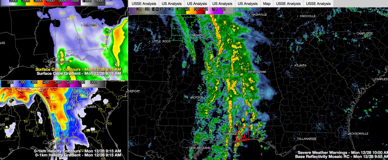
Click image to enlarge.
As we alluded to in our earlier posts, there is strong wind shear across the western half of Alabama this morning. So any storms that get going could produce a tornado.
Instability is low however over Central Alabama, so thus far, none of the storms have managed to become severe in this part of the state.
The best combination of instability and shear has been over coastal Alabama and Northwest Florida where radar confirmed damage occurred north of Pensacola earlier. The shear is even waning over Mobile, Baldwin and Washington Counties at this time, lessening their threat. There are no warnings in Alabama currently.
For Central Alabama for now, the biggest threat is for a damaging wind gust.
A few breaks in the clouds over East Alabama have allowed a little more heating and there is slightly more instability over the eastern portion of the state, so we will have to see if storms strengthen as we get into the afternoon.
Rain and some embedded thunder covers much of the western half of Alabama west of I-65 at this time.



