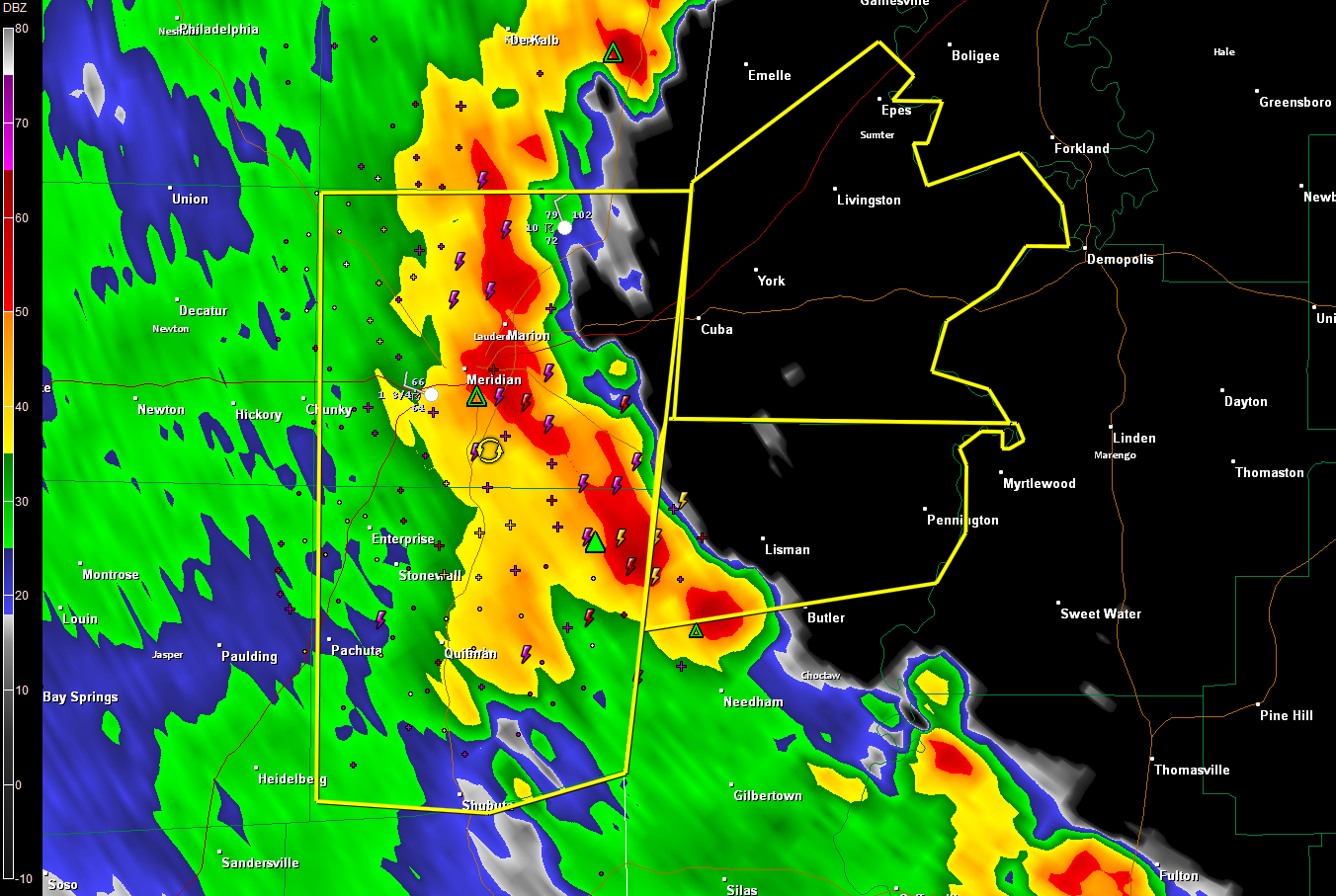
The NWS has issued a severe thunderstorm warning for southern Sumter County.
Strong storms from Meridian into northern Choctaw County will lift northeast into Sumter County over the next 30 minutes. These storms re interacting with the main line of strong storms over Lauderdale and Clarke Counties in Mississippi and will have the greatest threat for being severe. These will into Marengo, Sumter, southern Greene, Hale and Perry Counties over the next couple of hours.
Communities such as Cuba, York, Livingston and Epes will be affected. The storms will make driving on I-59/20 between Meridian and Epes quite difficult with heavy rain and strong winds.
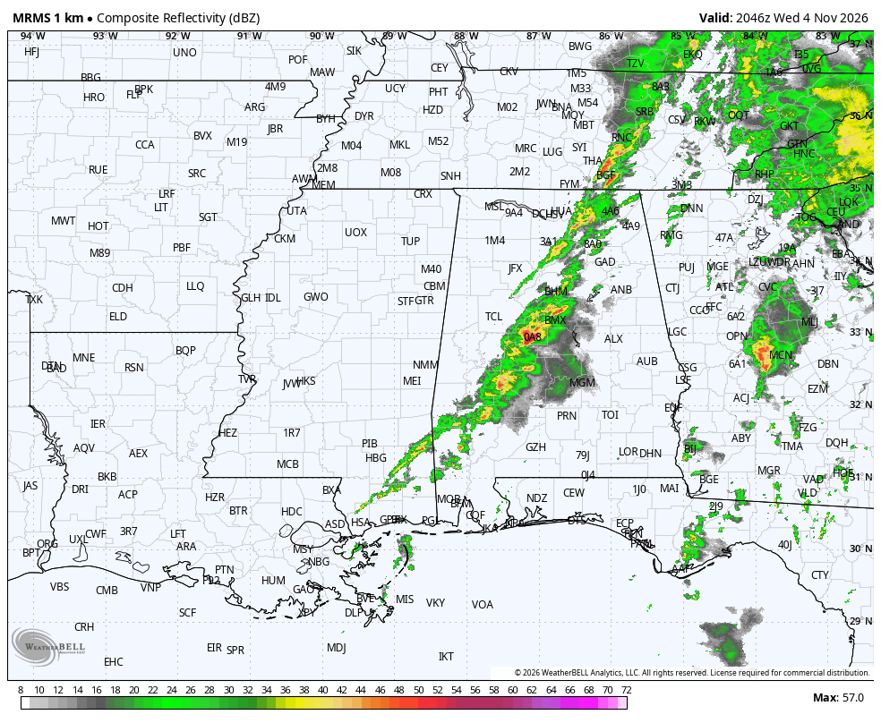
There will almost certainly be additional severe thunderstorm warnings in Central Alabama as the line of storms moves out of Mississippi, especially to the southwest.
To the north, the storms have weakened as they move into more stable air. Storms are lifting northeast now into Marion, Lamar and Pickens Counties. These storms are not severe, but will produce gusty winds, small hail and brief heavy rain.
The complex of storms over East Alabama has weakened. It brought strong winds and heavy rain to Montgomery at rush hour. It is now over Macon, Tallapoosa, CHambers and Lee Counties. It is not severe.
The SPC has issued a severe thunderstorm watch for the Tennessee Valley.
They say one is not going to be needed for the rest of Central Alabama.
Most of the Mississippi Counties have now been cleared from the watch.