


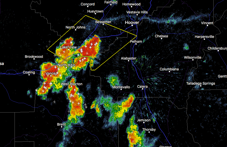

The National Weather Service in Birmingham has issued a
* Severe Thunderstorm Warning for…
East central Tuscaloosa County in west central Alabama…
West central Shelby County in central Alabama…
South central Jefferson County in central Alabama…
* Until 830 PM CDT.
* At 802 PM CDT, severe thunderstorms were located along a line extending from near Lake View to near Bessemer, moving northeast at 10 mph.
HAZARD…60 mph wind gusts and penny size hail.
SOURCE…Radar indicated.
IMPACT…Possible minor damage to roofs, siding, and trees.
* Locations impacted include…
Hoover, Bessemer, Pelham, Helena, Lake View, North Johns, Splash
Adventure, Tannehill Ironworks State Park, Abernant, Riverchase, Hoover Metropolitan Stadium, McCalla, Promenade Tannehill, Bucksville, Weller, Bent Brook Golf Club, McAdory, Caffee Junction, Bessemer Airport and Lake Cyrus.



